Approximate Location Map
Large Map »
Latitude: 51.4558 / 51°27'20"N
Longitude: 0.1309 / 0°7'51"E
OS Eastings: 548146
OS Northings: 175136
OS Grid: TQ481751
Mapcode National: GBR R4.1NX
Mapcode Global: VHHNS.7N1T
Plus Code: 9F32F44J+89
Entry Name: Outhouse to North East of Red House
Listing Date: 17 December 1980
Grade: II
Source: Historic England
Source ID: 1064204
English Heritage Legacy ID: 198717
ID on this website: 101064204
Location: Bexley, London, DA6
County: London
District: Bexley
Electoral Ward/Division: Christchurch
Parish: Non Civil Parish
Built-Up Area: Bexley
Traditional County: Kent
Lieutenancy Area (Ceremonial County): Greater London
Church of England Parish: Bexleyheath Christ Church
Church of England Diocese: Rochester
Tagged with: Outhouse
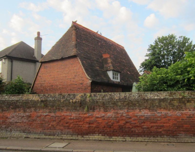
RED HOUSE LANE
1.
5005
Bexleyheath
Outhouse to north-east
TQ 4875 8/6C of Red House
II
GV
2.
1859. By Philip Webb. Red brick, with steeply pitched tiled roof; hipped
at one end. Included for its group value.
Listing NGR: TQ4814675136
External links are from the relevant listing authority and, where applicable, Wikidata. Wikidata IDs may be related buildings as well as this specific building. If you want to add or update a link, you will need to do so by editing the Wikidata entry.


Other nearby listed buildings
