Approximate Location Map
Large Map »
Latitude: 51.5337 / 51°32'1"N
Longitude: -0.197 / 0°11'49"W
OS Eastings: 525156
OS Northings: 183184
OS Grid: TQ251831
Mapcode National: GBR C7.30C
Mapcode Global: VHGQR.JQQ4
Plus Code: 9C3XGRM3+F6
Entry Name: 15-29, Princess Road
Listing Date: 28 March 1977
Grade: II
Source: Historic England
Source ID: 1078885
English Heritage Legacy ID: 198779
ID on this website: 101078885
Location: Kilburn, Brent, London, NW6
County: London
District: Brent
Electoral Ward/Division: Kilburn
Parish: Non Civil Parish
Built-Up Area: Brent
Traditional County: Middlesex
Lieutenancy Area (Ceremonial County): Greater London
Church of England Parish: St Augustine Kilburn
Church of England Diocese: London
Tagged with: Building
1.
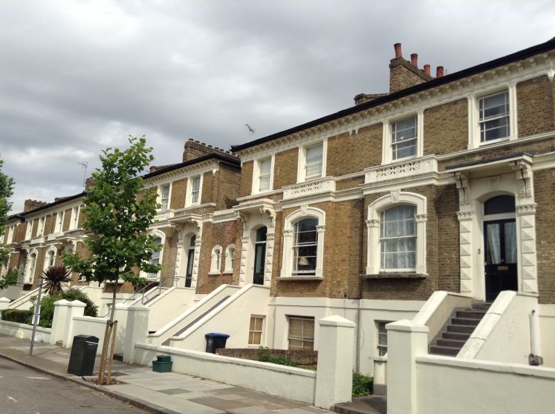
5006 PRINCESS ROAD
NW6
Nos 15 to 29 (odd)
TQ 2583 14/14 28.3.77
II GV
2.
Mid 19th century. Villas in pairs, 2 bays wide; brick with stucco dressings;
ground floor windows with segmental heads. Bracketed eaves cornice to slate
roof.
Listing NGR: TQ2515883187
External links are from the relevant listing authority and, where applicable, Wikidata. Wikidata IDs may be related buildings as well as this specific building. If you want to add or update a link, you will need to do so by editing the Wikidata entry.


Other nearby listed buildings
