Approximate Location Map
Large Map »
Latitude: 51.6146 / 51°36'52"N
Longitude: -0.2836 / 0°17'0"W
OS Eastings: 518937
OS Northings: 192040
OS Grid: TQ189920
Mapcode National: GBR 7P.Z23
Mapcode Global: VHGQB.1PF2
Plus Code: 9C3XJP78+VH
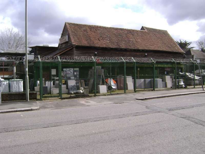
Entry Name: Barn Immediately to the South of Nicoll's Farm
Listing Date: 24 January 1983
Grade: II
Source: Historic England
Source ID: 1064819
English Heritage Legacy ID: 199082
ID on this website: 101064819
Location: Edgware, Barnet, London, HA8
County: London
District: Barnet
Electoral Ward/Division: Edgware
Parish: Non Civil Parish
Built-Up Area: Harrow
Traditional County: Middlesex
Lieutenancy Area (Ceremonial County): Greater London
Church of England Parish: St Margaret Edgware
Church of England Diocese: London
Tagged with: Barn
1. STONE GROVE, EDGWARE
5004
Barn immediately to the
south of Nicoll's Farm
TQ 19 SE 4/5 24.1.83
II
2.
Late C17 or early C18. Large timber framed and weatherboarded barn with old
tile roof.
Listing NGR: TQ1893792040
External links are from the relevant listing authority and, where applicable, Wikidata. Wikidata IDs may be related buildings as well as this specific building. If you want to add or update a link, you will need to do so by editing the Wikidata entry.


Other nearby listed buildings
