Approximate Location Map
Large Map »
Latitude: 51.6251 / 51°37'30"N
Longitude: -0.1945 / 0°11'40"W
OS Eastings: 525075
OS Northings: 193347
OS Grid: TQ250933
Mapcode National: GBR C1.9N3
Mapcode Global: VHGQC.LF02
Plus Code: 9C3XJRG4+25
Entry Name: Home Farm
Listing Date: 7 April 1983
Grade: II
Source: Historic England
Source ID: 1286664
English Heritage Legacy ID: 199100
ID on this website: 101286664
Location: Woodside Park, Barnet, London, N20
County: London
District: Barnet
Electoral Ward/Division: Totteridge
Parish: Non Civil Parish
Built-Up Area: Barnet
Traditional County: Hertfordshire
Lieutenancy Area (Ceremonial County): Greater London
Church of England Parish: Totteridge
Church of England Diocese: St.Albans
Tagged with: Agricultural structure
1.
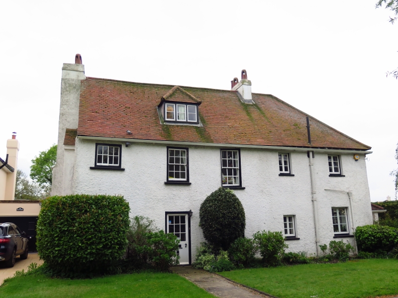
5004 TOTTERIDGE GREEN
N20
Home Farm
TQ 2593 15/10
II GV
2.
Late C17 3 windows. Two storeys with dormered attics. Later 2 storey addition
to right. Timber framed with early brick stack in left hand gable end. Modern
tile roof.
Listing NGR: TQ2507593347
External links are from the relevant listing authority and, where applicable, Wikidata. Wikidata IDs may be related buildings as well as this specific building. If you want to add or update a link, you will need to do so by editing the Wikidata entry.


Other nearby listed buildings
