Approximate Location Map
Large Map »
Latitude: 51.6532 / 51°39'11"N
Longitude: -0.2036 / 0°12'13"W
OS Eastings: 524368
OS Northings: 196467
OS Grid: TQ243964
Mapcode National: GBR BZ.FBB
Mapcode Global: VHGQ5.FP6Z
Plus Code: 9C3XMQ3W+7H
Entry Name: 32, Wood Street
Listing Date: 7 April 1983
Grade: II
Source: Historic England
Source ID: 1359103
English Heritage Legacy ID: 199169
ID on this website: 101359103
Location: Chipping Barnet, Barnet, London, EN5
County: London
District: Barnet
Electoral Ward/Division: High Barnet
Parish: Non Civil Parish
Built-Up Area: Barnet
Traditional County: Hertfordshire
Lieutenancy Area (Ceremonial County): Greater London
Church of England Parish: Chipping Barnet
Church of England Diocese: St.Albans
Tagged with: Building
1.
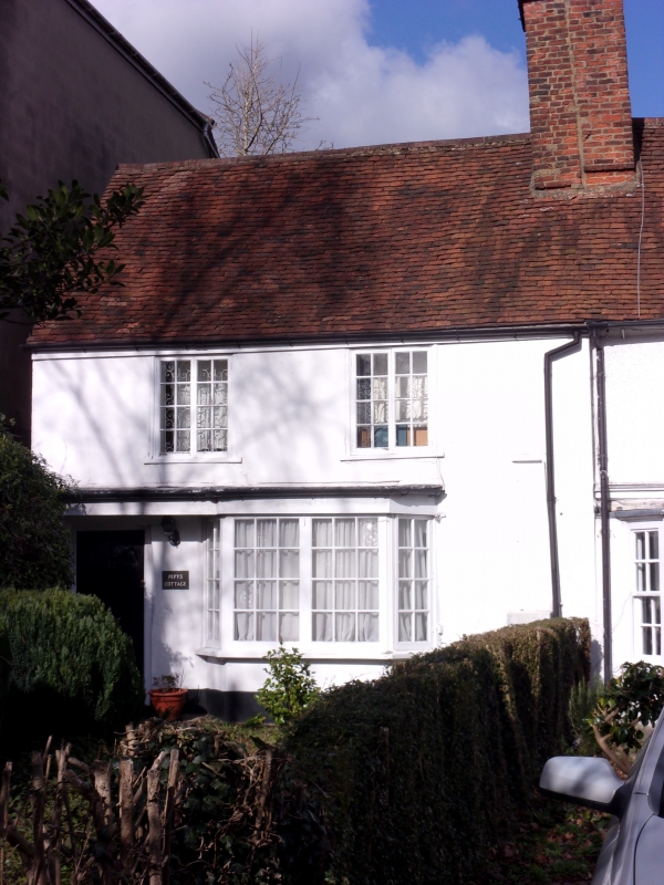
5004 WOOD STREET
(north side)
No 32
TQ 2496 10/16
II GV
2.
Possibly a mid C16 timber framed tenement house. Rendered. Two windows. Two storeys.
Canted bay to ground storey. Two light wooden casements above. Old tile roof with
tall brick stack.
Listing NGR: TQ2436896470
External links are from the relevant listing authority and, where applicable, Wikidata. Wikidata IDs may be related buildings as well as this specific building. If you want to add or update a link, you will need to do so by editing the Wikidata entry.


Other nearby listed buildings
