Approximate Location Map
Large Map »
Latitude: 51.5145 / 51°30'52"N
Longitude: -0.1115 / 0°6'41"W
OS Eastings: 531140
OS Northings: 181195
OS Grid: TQ311811
Mapcode National: GBR MC.38
Mapcode Global: VHGR0.06XB
Plus Code: 9C3XGV7Q+QC
Entry Name: 116, Chancery Lane WC2
Listing Date: 5 June 1972
Grade: II
Source: Historic England
Source ID: 1192050
English Heritage Legacy ID: 199364
ID on this website: 101192050
Location: Holborn, Westminster, London, WC2A
County: London
District: City of Westminster
Electoral Ward/Division: St James's
Parish: Non Civil Parish
Built-Up Area: City of Westminster
Traditional County: Middlesex
Lieutenancy Area (Ceremonial County): Greater London
Church of England Parish: St Bride Fleet Street
Church of England Diocese: London
Tagged with: Building
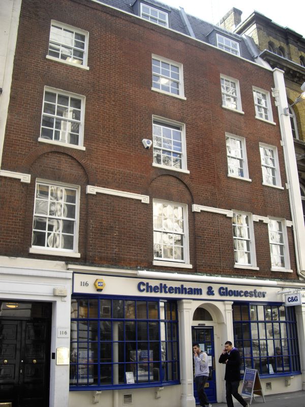
CHANCERY LANE WC2
1.
5002
(West Side)
No 116
TQ 3181 SW 7/67 5.6.72.
II GV
2.
Early C19. Formerly 2 houses. 4 storeys, each 2 windows. Southern part has plain front of coloured brick with 1st floor impost-band and arcade. Shop and passage-entry leading to building at rear.
Listing NGR: TQ3112681188
External links are from the relevant listing authority and, where applicable, Wikidata. Wikidata IDs may be related buildings as well as this specific building. If you want to add or update a link, you will need to do so by editing the Wikidata entry.


Other nearby listed buildings
