Approximate Location Map
Large Map »
Latitude: 51.5134 / 51°30'48"N
Longitude: -0.0867 / 0°5'12"W
OS Eastings: 532863
OS Northings: 181122
OS Grid: TQ328811
Mapcode National: GBR SC.PN
Mapcode Global: VHGR0.G705
Plus Code: 9C3XGW77+98
Entry Name: Pump on Pavement South of Royal Exchange
Listing Date: 4 January 1950
Grade: II
Source: Historic England
Source ID: 1286648
English Heritage Legacy ID: 199408
ID on this website: 101286648
Location: City of London, London, EC3V
County: London
District: City and County of the City of London
Electoral Ward/Division: Langbourn
Parish: Non Civil Parish
Built-Up Area: City of London
Traditional County: Middlesex
Lieutenancy Area (Ceremonial County): City of London
Church of England Parish: St Michael Cornhill
Church of England Diocese: London
Tagged with: Water pump
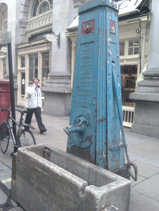
CORNHILL EC3
1.
5002 (North Side)
Pump on pavement to south
of Royal Exchange
TQ 3281 SE 10/298 4.1.50.
II
2.
Dated 1799. Obelisk of cast iron with canted corners, slight decoration and long
inscriptions. Granite trough probably of later date.
Listing NGR: TQ3286381122
External links are from the relevant listing authority and, where applicable, Wikidata. Wikidata IDs may be related buildings as well as this specific building. If you want to add or update a link, you will need to do so by editing the Wikidata entry.


Other nearby listed buildings
