Approximate Location Map
Large Map »
Latitude: 51.5137 / 51°30'49"N
Longitude: -0.1107 / 0°6'38"W
OS Eastings: 531196
OS Northings: 181112
OS Grid: TQ311811
Mapcode National: GBR MC.9K
Mapcode Global: VHGR0.16BX
Plus Code: 9C3XGV7Q+FP
Entry Name: 18 and 19, Fleet Street EC4
Listing Date: 5 June 1972
Grade: II
Source: Historic England
Source ID: 1286507
English Heritage Legacy ID: 199456
ID on this website: 101286507
Location: Holborn, City of London, London, EC4Y
County: London
District: City and County of the City of London
Electoral Ward/Division: Farringdon Without
Parish: Non Civil Parish
Built-Up Area: City of London
Traditional County: Middlesex
Lieutenancy Area (Ceremonial County): City of London
Church of England Parish: St Bride Fleet Street
Church of England Diocese: London
Tagged with: Building
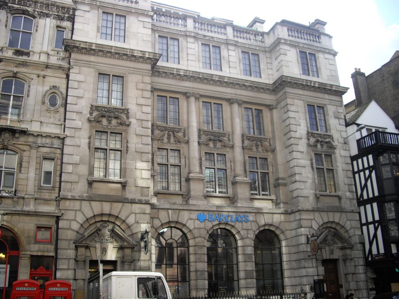
FLEET STREET EC4
1.
5002
(South Side)
Nos 18 and 19
TQ 3181 SW 7/119 5.6.72.
II GV
2.
1898-9, by Sir Arthur Blomfield and Son (?) Free classical style. Portland stone. 4 storeys plus dormers.
Listing NGR: TQ3120181104
External links are from the relevant listing authority and, where applicable, Wikidata. Wikidata IDs may be related buildings as well as this specific building. If you want to add or update a link, you will need to do so by editing the Wikidata entry.


Other nearby listed buildings
