Approximate Location Map
Large Map »
Latitude: 51.5143 / 51°30'51"N
Longitude: -0.0915 / 0°5'29"W
OS Eastings: 532528
OS Northings: 181215
OS Grid: TQ325812
Mapcode National: GBR RC.LB
Mapcode Global: VHGR0.C6HG
Plus Code: 9C3XGW75+PC
Entry Name: 4, Frederick's Place EC2
Listing Date: 4 January 1950
Grade: II
Source: Historic England
Source ID: 1192710
English Heritage Legacy ID: 199480
ID on this website: 101192710
Location: City of London, London, EC2R
County: London
District: City and County of the City of London
Electoral Ward/Division: Cheap
Parish: Non Civil Parish
Built-Up Area: City of London
Traditional County: Middlesex
Lieutenancy Area (Ceremonial County): City of London
Church of England Parish: St Mary le Bow Cheapside
Church of England Diocese: London
Tagged with: Building
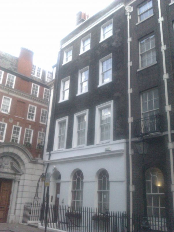
FREDERICK'S PLACE EC2R
1.
5002
(North Side)
No 4
TQ 3281 SE 10/265 4.1.50.
II GV
2.
Later C18. Similar to No 3 but with stuccoed ground storey and 1st floor architraves.
Single storey of dormers in slated roof. Plainer railings and lamp arch.
Listing NGR: TQ3252881215
External links are from the relevant listing authority and, where applicable, Wikidata. Wikidata IDs may be related buildings as well as this specific building. If you want to add or update a link, you will need to do so by editing the Wikidata entry.


Other nearby listed buildings
