Approximate Location Map
Large Map »
Latitude: 51.512 / 51°30'43"N
Longitude: -0.1093 / 0°6'33"W
OS Eastings: 531299
OS Northings: 180927
OS Grid: TQ312809
Mapcode National: GBR MD.M4
Mapcode Global: VHGR0.2827
Plus Code: 9C3XGV6R+R7
Entry Name: 5, Paper Buildings
Listing Date: 10 November 1977
Grade: II
Source: Historic England
Source ID: 1359179
English Heritage Legacy ID: 199546
ID on this website: 101359179
Location: Holborn, City of London, London, EC4Y
County: London
District: City and County of the City of London
Electoral Ward/Division: Farringdon Without
Parish: Non Civil Parish
Built-Up Area: City of London
Traditional County: Middlesex
Lieutenancy Area (Ceremonial County): City of London
Tagged with: Building
TQ 3180 NW
13/N/2
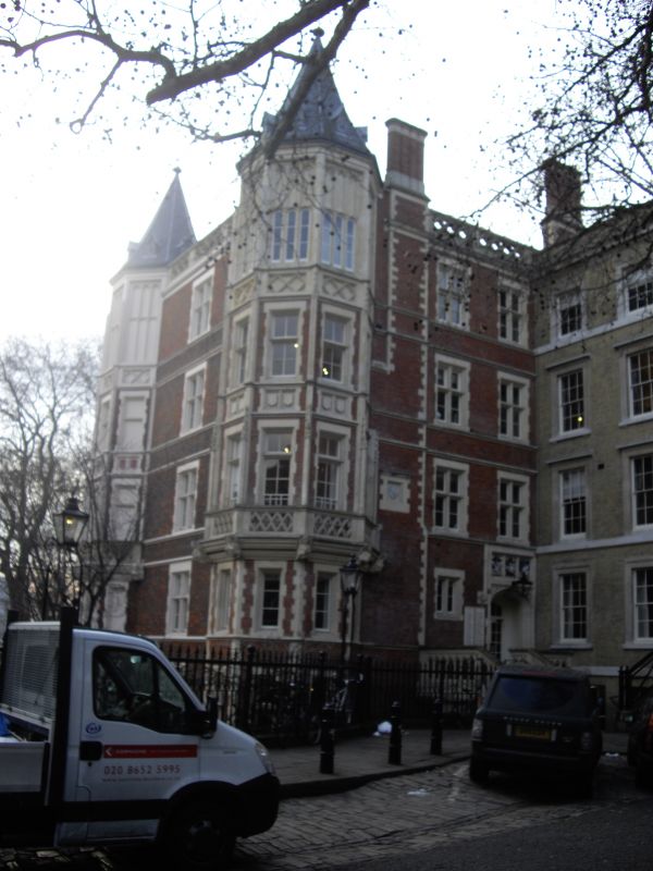
INNER TEMPLE EC4
Paper Buildings
No. 5
GV
II
1848, by Sydney Smirke. Tudor style. Red brick with blue brick diapering, stone
window dressings, quoins and strings. 5 storeys. Mullioned and transomed windows,
5 storey canted bay windows on south front. Polygonal corner towers.
Listing NGR: TQ3129980927
External links are from the relevant listing authority and, where applicable, Wikidata. Wikidata IDs may be related buildings as well as this specific building. If you want to add or update a link, you will need to do so by editing the Wikidata entry.


Other nearby listed buildings
