Approximate Location Map
Large Map »
Latitude: 51.5135 / 51°30'48"N
Longitude: -0.1063 / 0°6'22"W
OS Eastings: 531500
OS Northings: 181098
OS Grid: TQ315810
Mapcode National: GBR NC.8M
Mapcode Global: VHGR0.37N2
Plus Code: 9C3XGV7V+CF
Entry Name: Obelisk in Centre of Roadway
Listing Date: 5 June 1972
Last Amended: 10 November 1977
Grade: II
Source: Historic England
Source ID: 1079124
English Heritage Legacy ID: 199749
ID on this website: 101079124
Location: Holborn, City of London, London, EC4Y
County: London
District: City and County of the City of London
Electoral Ward/Division: Castle Baynard
Parish: Non Civil Parish
Built-Up Area: City of London
Traditional County: Middlesex
Lieutenancy Area (Ceremonial County): City of London
Church of England Parish: St Bride Fleet Street
Church of England Diocese: London
SALISBURY SQUARE EC4
1.
5002
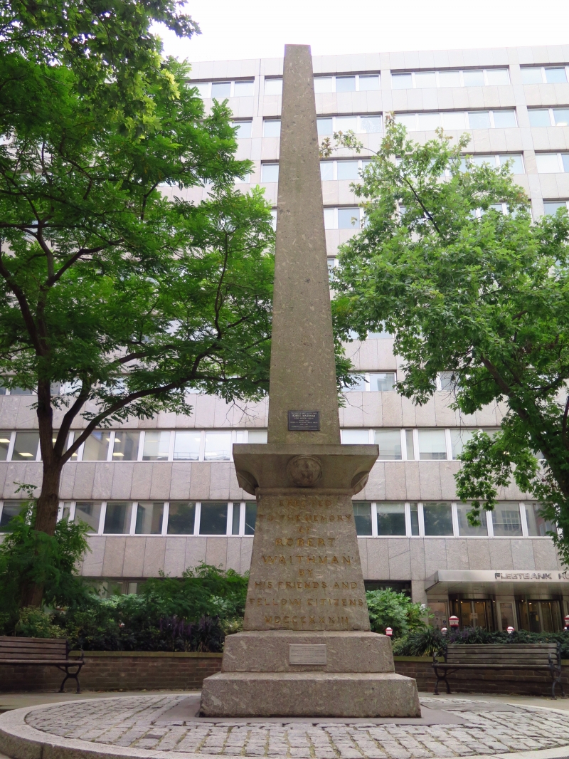
Obelisk in centre of roadway
(Formerly listed under
Bartholomew Close EC1)
TQ 3181 SW 7/31 5.6.72.
II
2.
1833. Grey granite obelisk to Robert Waithman MP former Lord Mayor.
Listing NGR: TQ3150081097
External links are from the relevant listing authority and, where applicable, Wikidata. Wikidata IDs may be related buildings as well as this specific building. If you want to add or update a link, you will need to do so by editing the Wikidata entry.


Other nearby listed buildings
