Approximate Location Map
Large Map »
Latitude: 51.4861 / 51°29'9"N
Longitude: 0.0647 / 0°3'52"E
OS Eastings: 543454
OS Northings: 178368
OS Grid: TQ434783
Mapcode National: GBR NK.2Z4
Mapcode Global: VHHNK.2XK4
Plus Code: 9F32F3P7+CV
Entry Name: Wall to South East of Connaught Barracks
Listing Date: 8 June 1973
Last Amended: 31 December 1973
Grade: II
Source: Historic England
Source ID: 1078984
English Heritage Legacy ID: 200357
ID on this website: 101078984
Location: Woolwich, Greenwich, London, SE18
County: London
District: Greenwich
Electoral Ward/Division: Woolwich Common
Parish: Non Civil Parish
Built-Up Area: Greenwich
Traditional County: Kent
Lieutenancy Area (Ceremonial County): Greater London
Church of England Parish: Woolwich St Mary Magdalene with St Michael and All Angels
Church of England Diocese: Southwark
Tagged with: Wall
1.
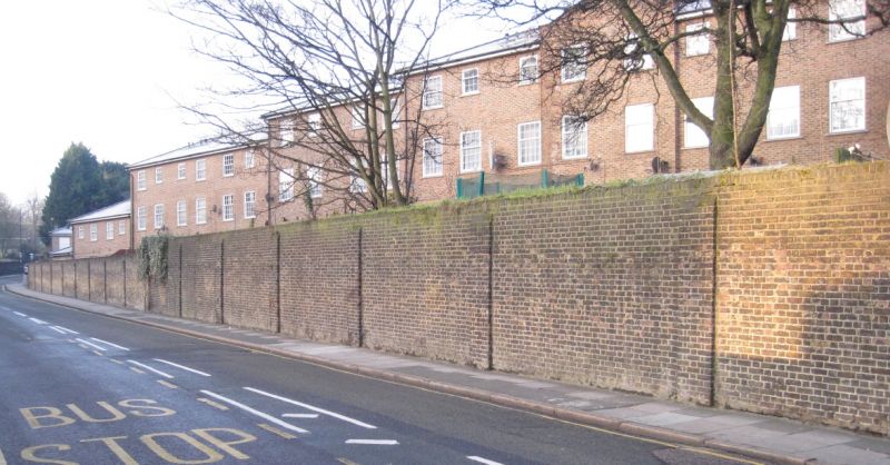
4412 WOOLWICH NEW ROAD SE18
Wall to South-east of
Connaught Barracks
TQ 4378 20/W17B
II
2.
Late C18 or early C19 brick wall of 9 ft with sloped coping. Extra height added
later and ramped up in places.
Listing NGR: TQ4345478368
External links are from the relevant listing authority and, where applicable, Wikidata. Wikidata IDs may be related buildings as well as this specific building. If you want to add or update a link, you will need to do so by editing the Wikidata entry.


Other nearby listed buildings
