Approximate Location Map
Large Map »
Latitude: 51.6478 / 51°38'52"N
Longitude: -0.1322 / 0°7'55"W
OS Eastings: 529323
OS Northings: 195985
OS Grid: TQ293959
Mapcode National: GBR FH.TJZ
Mapcode Global: VHGQ6.NVG5
Plus Code: 9C3XJVX9+44
Entry Name: Station Sign to North of Oakwood Station
Listing Date: 19 February 1971
Grade: II
Source: Historic England
Source ID: 1358982
English Heritage Legacy ID: 200527
ID on this website: 101358982
Location: Oakwood, Enfield, London, N14
County: London
District: Enfield
Electoral Ward/Division: Cockfosters
Parish: Non Civil Parish
Built-Up Area: Enfield
Traditional County: Middlesex
Lieutenancy Area (Ceremonial County): Greater London
Church of England Parish: St Thomas Oakwood
Church of England Diocese: London
Tagged with: Architectural structure
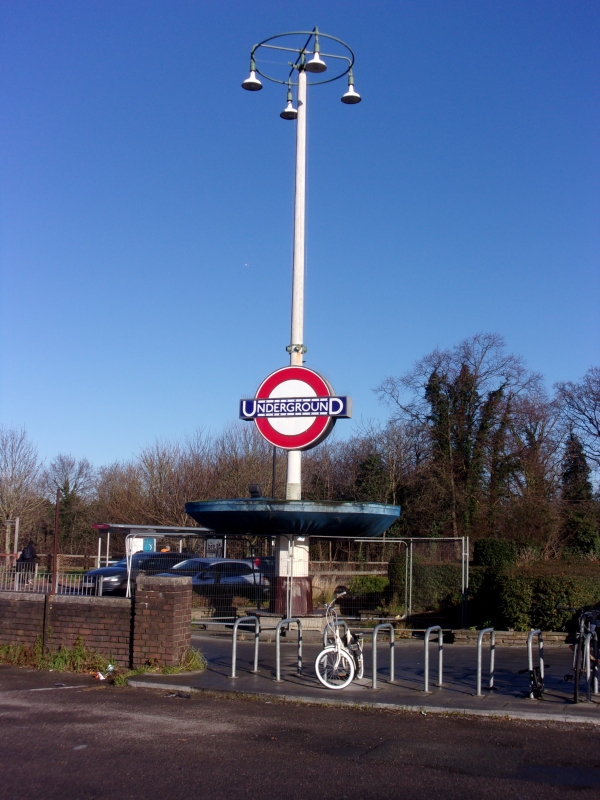
1.
4411 BRAMLEY ROAD N14
(South Side)
Station sign to
north of Oakwood
Station
TQ 29 NE 19/19
II
2.
Reinforced-concrete construction with pedestrian shelter at base of post carrying
sign.
0akwood Station and the sign form a group.
Listing NGR: TQ2932395985
External links are from the relevant listing authority and, where applicable, Wikidata. Wikidata IDs may be related buildings as well as this specific building. If you want to add or update a link, you will need to do so by editing the Wikidata entry.


Other nearby listed buildings
