Approximate Location Map
Large Map »
Latitude: 51.6547 / 51°39'16"N
Longitude: -0.0872 / 0°5'14"W
OS Eastings: 532414
OS Northings: 196834
OS Grid: TQ324968
Mapcode National: GBR H5.6PV
Mapcode Global: VHGQ7.FNRV
Plus Code: 9C3XMW37+V4
Entry Name: The Haven
Listing Date: 31 January 1974
Grade: II
Source: Historic England
Source ID: 1358704
English Heritage Legacy ID: 200650
ID on this website: 101358704
Location: Enfield, London, EN2
County: London
District: Enfield
Electoral Ward/Division: Town
Parish: Non Civil Parish
Built-Up Area: Enfield
Traditional County: Middlesex
Lieutenancy Area (Ceremonial County): Greater London
Church of England Parish: St Andrew Enfield
Church of England Diocese: London
Tagged with: Architectural structure
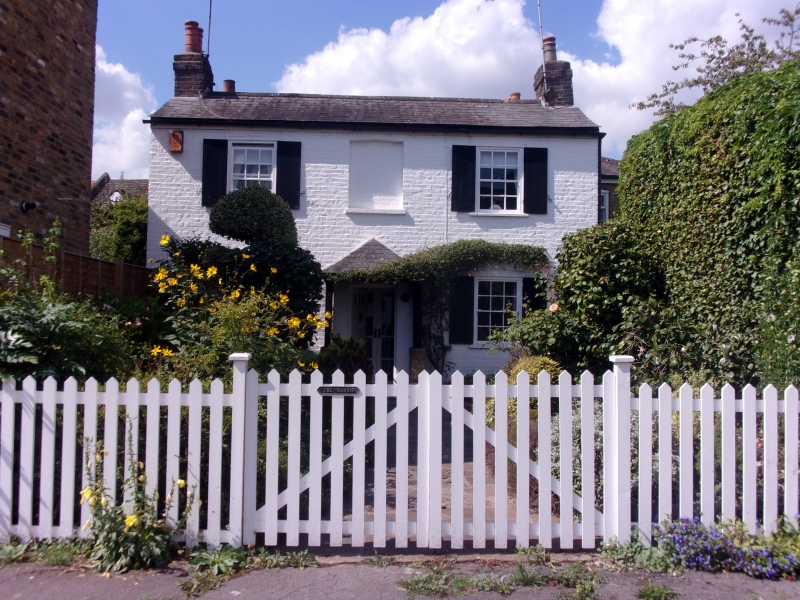
1.
4411 GENTLEMAN'S ROW
(West Side)
No 16 (The Haven)
TQ 3296 7/172
II
2.
Early C19 cottage of 2 storeys, 3 windows. Low pitched slated roof. Painted
brick front. Sash windows with glazing bars, that at lst floor centre blocked.
External boarded shutters. Original door under later trellis hood.
Listing NGR: TQ3241496834
External links are from the relevant listing authority and, where applicable, Wikidata. Wikidata IDs may be related buildings as well as this specific building. If you want to add or update a link, you will need to do so by editing the Wikidata entry.


Other nearby listed buildings
