Approximate Location Map
Large Map »
Latitude: 51.4982 / 51°29'53"N
Longitude: -0.2559 / 0°15'21"W
OS Eastings: 521164
OS Northings: 179139
OS Grid: TQ211791
Mapcode National: GBR 9M.666
Mapcode Global: VHGQX.JL2T
Plus Code: 9C3XFPXV+7J
Entry Name: 16 and 18, the Avenue W4
Listing Date: 2 February 1970
Grade: II
Source: Historic England
Source ID: 1079436
English Heritage Legacy ID: 200878
ID on this website: 101079436
Location: Bedford Park, Ealing, London, W4
County: London
District: Ealing
Electoral Ward/Division: Southfield
Parish: Non Civil Parish
Built-Up Area: Ealing
Traditional County: Middlesex
Lieutenancy Area (Ceremonial County): Greater London
Church of England Parish: St Michael and All Angels Bedford Park
Church of England Diocese: London
Tagged with: Building
THE AVENUE
1.
5010
(east side)
W4
Nos 16 and 18
TQ 2179 7/64A 2.2.70
II GV
2.
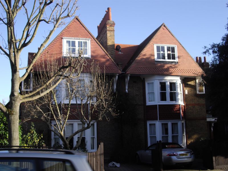
Circa 1877. By Coe and Robinson. Pair of red and yellow brick houses, partly
tile hung and with tiled roofs. Two storeys and attics, tile hung gables
above 2 storeyed bays. Hooded entrance doors on side elevations.
Listing NGR: TQ2116479139
External links are from the relevant listing authority and, where applicable, Wikidata. Wikidata IDs may be related buildings as well as this specific building. If you want to add or update a link, you will need to do so by editing the Wikidata entry.


Other nearby listed buildings
