Approximate Location Map
Large Map »
Latitude: 51.4991 / 51°29'56"N
Longitude: -0.255 / 0°15'18"W
OS Eastings: 521222
OS Northings: 179238
OS Grid: TQ212792
Mapcode National: GBR 9M.6DG
Mapcode Global: VHGQX.JLK4
Plus Code: 9C3XFPXV+JX
Entry Name: 8, Blenheim Road
Listing Date: 2 February 1970
Grade: II
Source: Historic England
Source ID: 1079447
English Heritage Legacy ID: 200904
ID on this website: 101079447
Location: Bedford Park, Ealing, London, W4
County: London
District: Ealing
Electoral Ward/Division: Southfield
Parish: Non Civil Parish
Built-Up Area: Ealing
Traditional County: Middlesex
Lieutenancy Area (Ceremonial County): Greater London
Church of England Parish: St Michael and All Angels Bedford Park
Church of England Diocese: London
Tagged with: Building
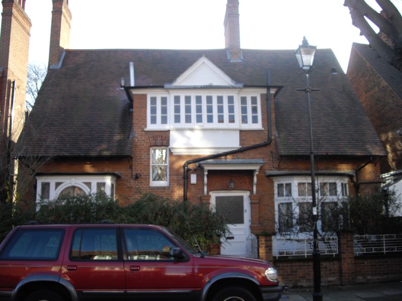
BLENHEIM ROAD
1.
5010
(south side)
No 8
TQ 2179 7/57 2.2.70
II GV
2.
Circa 1876. By W Wilson. Red brick with tiled roof. Two storeys. Differing
single storey bays. One pier remains to the front garden.
Listing NGR: TQ2122279238
External links are from the relevant listing authority and, where applicable, Wikidata. Wikidata IDs may be related buildings as well as this specific building. If you want to add or update a link, you will need to do so by editing the Wikidata entry.


Other nearby listed buildings
