Approximate Location Map
Large Map »
Latitude: 51.5059 / 51°30'21"N
Longitude: -0.3812 / 0°22'52"W
OS Eastings: 512449
OS Northings: 179798
OS Grid: TQ124797
Mapcode National: GBR 4K.YBM
Mapcode Global: VHFTD.BDVW
Plus Code: 9C3XGJ49+9G
Entry Name: The Water Tower
Listing Date: 9 October 1972
Grade: II
Source: Historic England
Source ID: 1079411
English Heritage Legacy ID: 200919
ID on this website: 101079411
Location: Southall, Ealing, London, UB1
County: London
District: Ealing
Electoral Ward/Division: Southall Broadway
Parish: Non Civil Parish
Built-Up Area: Ealing
Traditional County: Middlesex
Lieutenancy Area (Ceremonial County): Greater London
Church of England Parish: St George Southall
Church of England Diocese: London
Tagged with: Tower
THE CRESCENT
1.
5010
Southall
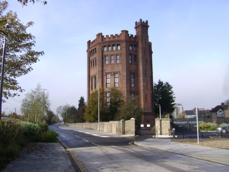
The Water Tower
TQ 17 NW 4/2 9.10.72
II
2.
Late C19. Red brick. Four stage hexagonal tower with 2 windows on each face with
3 on the top floor; drip moulds over. Vestigial corner turrets, stair turret
on one face. Machicolations, battlemented parapet.
Listing NGR: TQ1244979798
External links are from the relevant listing authority and, where applicable, Wikidata. Wikidata IDs may be related buildings as well as this specific building. If you want to add or update a link, you will need to do so by editing the Wikidata entry.


Other nearby listed buildings
