Approximate Location Map
Large Map »
Latitude: 51.3747 / 51°22'29"N
Longitude: -0.0751 / 0°4'30"W
OS Eastings: 534073
OS Northings: 165721
OS Grid: TQ340657
Mapcode National: GBR HR.3QW
Mapcode Global: VHGRL.NQ50
Plus Code: 9C3X9WFF+VX
Entry Name: Heron's Croft
Listing Date: 7 July 1969
Grade: II
Source: Historic England
Source ID: 1358805
English Heritage Legacy ID: 201151
ID on this website: 101358805
Location: Addiscombe, Croydon, London, CR0
County: London
District: Croydon
Electoral Ward/Division: Addiscombe
Parish: Non Civil Parish
Built-Up Area: Croydon
Traditional County: Surrey
Lieutenancy Area (Ceremonial County): Greater London
Church of England Parish: Croydon St Matthew
Church of England Diocese: Southwark
Tagged with: Architectural structure
1.
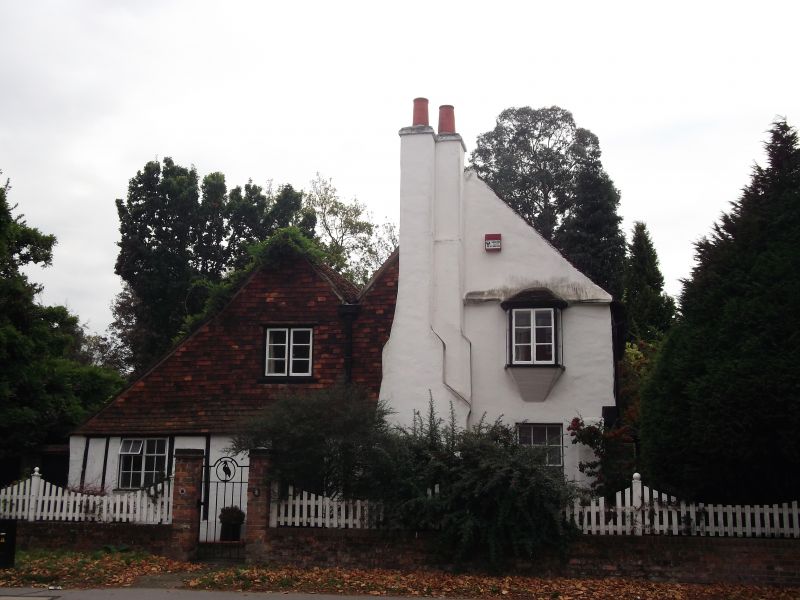
5009 ADDISCOMBE ROAD
No 96
TQ 36 NW 2/37 7.7.69 (Heron's Croft)
II
2.
C17 cottage. Two storeys. Two-span. End stacks. Jettied. Catslide roof to rear.
Various windows. Old tile roof.
Listing NGR: TQ3407365721
External links are from the relevant listing authority and, where applicable, Wikidata. Wikidata IDs may be related buildings as well as this specific building. If you want to add or update a link, you will need to do so by editing the Wikidata entry.


Other nearby listed buildings
