Approximate Location Map
Large Map »
Latitude: 51.3664 / 51°21'58"N
Longitude: -0.1012 / 0°6'4"W
OS Eastings: 532280
OS Northings: 164746
OS Grid: TQ322647
Mapcode National: GBR GX.P51
Mapcode Global: VHGRL.6XCD
Plus Code: 9C3X9V8X+HG
Entry Name: 88, Southbridge Road
Listing Date: 15 February 1983
Grade: II
Source: Historic England
Source ID: 1079268
English Heritage Legacy ID: 201248
ID on this website: 101079268
Location: Croydon, London, CR0
County: London
District: Croydon
Electoral Ward/Division: Waddon
Parish: Non Civil Parish
Built-Up Area: Croydon
Traditional County: Surrey
Lieutenancy Area (Ceremonial County): Greater London
Church of England Parish: Croydon St Andrew
Church of England Diocese: Southwark
Tagged with: Building
1.
5009 SOUTHBRIDGE ROAD
No 88
TQ 36 SW 5/3
II
2.
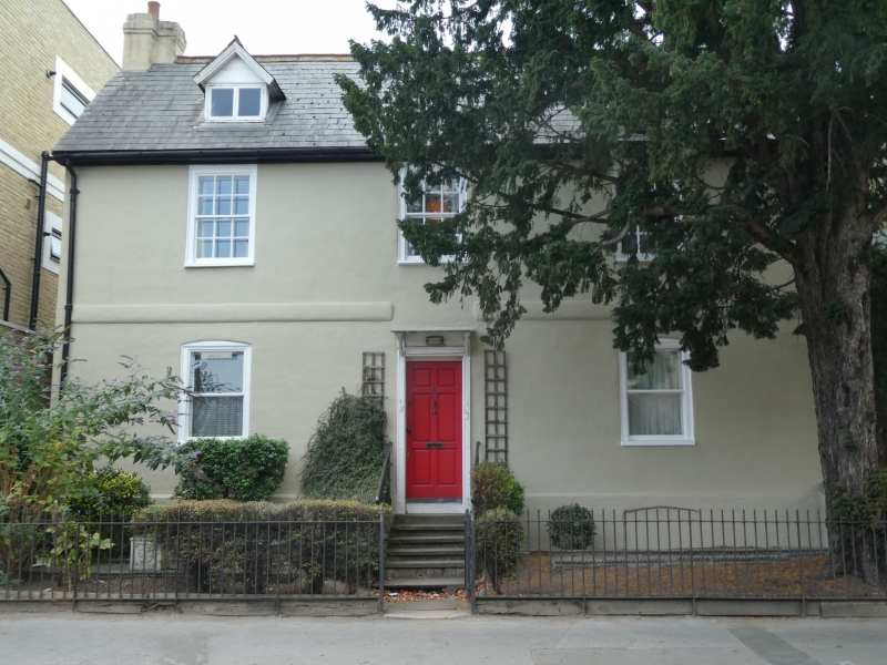
Mid C18 house. Two storeys, basement and attic. Red brick, colourwashed. Three
sash windows with glazing bars to first floor. Modern central door with old frame
and hood. Raised brick band between storeys. Slate roof. Two dormers. Later
additions at rear.
Listing NGR: TQ3228064746
External links are from the relevant listing authority and, where applicable, Wikidata. Wikidata IDs may be related buildings as well as this specific building. If you want to add or update a link, you will need to do so by editing the Wikidata entry.


Other nearby listed buildings
