Approximate Location Map
Large Map »
Latitude: 51.3894 / 51°23'21"N
Longitude: -0.0653 / 0°3'55"W
OS Eastings: 534711
OS Northings: 167367
OS Grid: TQ347673
Mapcode National: GBR JK.66V
Mapcode Global: VHGRL.TBBR
Plus Code: 9C3X9WQM+PV
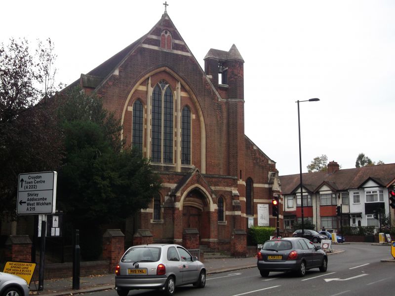
Entry Name: Church of St Luke
Listing Date: 29 October 1976
Grade: II
Source: Historic England
Source ID: 1079281
English Heritage Legacy ID: 201272
ID on this website: 101079281
Location: Woodside, Croydon, London, SE25
County: London
District: Croydon
Electoral Ward/Division: Woodside
Parish: Non Civil Parish
Built-Up Area: Croydon
Traditional County: Surrey
Lieutenancy Area (Ceremonial County): Greater London
Church of England Parish: Woodside St Luke
Church of England Diocese: Southwark
Tagged with: Church building
TQ 36 NW
2/32
WOODSIDE GREEN
Church of St Luke
29.10.76
II
1870, by W.V Arnold; east end rebuilt to the designs of W.D Caröe in 1949. Red brick, stone dressings, horizontal banding, lancet windows. Red brick interior. No tower. Pointed diaphragm arches across nave.
Listing NGR: TQ3471167367
External links are from the relevant listing authority and, where applicable, Wikidata. Wikidata IDs may be related buildings as well as this specific building. If you want to add or update a link, you will need to do so by editing the Wikidata entry.


Other nearby listed buildings
