Approximate Location Map
Large Map »
Latitude: 51.5326 / 51°31'57"N
Longitude: 0.236 / 0°14'9"E
OS Eastings: 555186
OS Northings: 183893
OS Grid: TQ551838
Mapcode National: GBR VB.454
Mapcode Global: VHHNG.1QLY
Plus Code: 9F32G6MP+29
Entry Name: Garden Wall to Former Gerpins Farmhouse
Listing Date: 14 September 1979
Grade: II
Source: Historic England
Source ID: 1183652
English Heritage Legacy ID: 201572
ID on this website: 101183652
Location: Havering, London, RM14
County: London
District: Havering
Electoral Ward/Division: Upminster
Parish: Non Civil Parish
Traditional County: Essex
Lieutenancy Area (Ceremonial County): Greater London
Church of England Parish: Rainham
Church of England Diocese: Chelmsford
Tagged with: Wall
1.
5017
TQ 58 SE
14/9
GERPINS LANE
Upminster
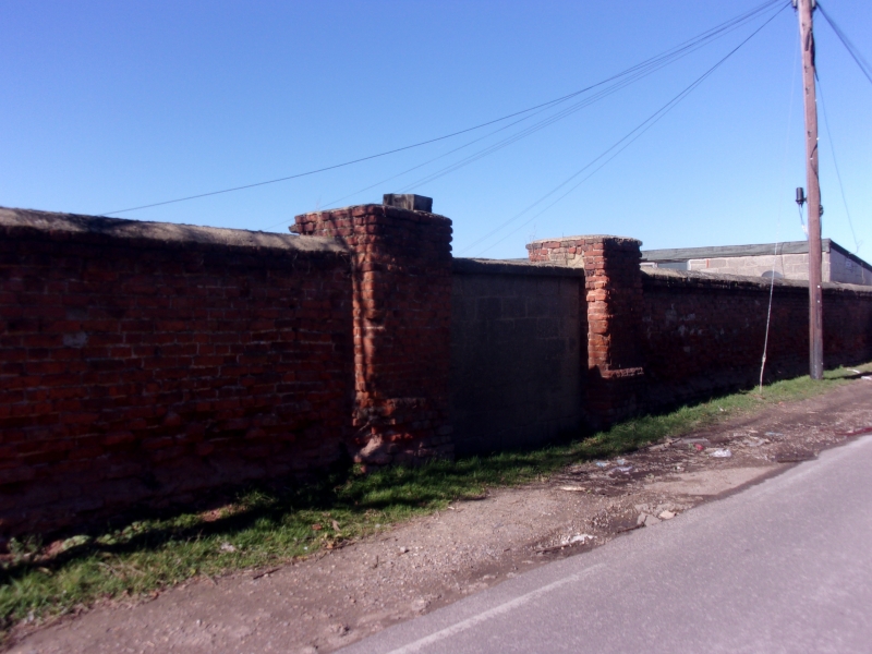
Garden wall to former Gerpins Farmhouse
II
2.
Late C17-early C18 garden wall. The house has been destroyed.
Listing NGR: TQ5518683893
External links are from the relevant listing authority and, where applicable, Wikidata. Wikidata IDs may be related buildings as well as this specific building. If you want to add or update a link, you will need to do so by editing the Wikidata entry.


Other nearby listed buildings
