Approximate Location Map
Large Map »
Latitude: 51.5692 / 51°34'9"N
Longitude: 0.2558 / 0°15'20"E
OS Eastings: 556435
OS Northings: 188007
OS Grid: TQ564880
Mapcode National: GBR W2.WNT
Mapcode Global: VHHN8.DT2D
Plus Code: 9F32H794+M8
Entry Name: Stable Block at Upminster Court
Listing Date: 14 September 1979
Grade: II
Source: Historic England
Source ID: 1183723
English Heritage Legacy ID: 201577
ID on this website: 101183723
Location: Cranham, Havering, London, RM14
County: London
District: Havering
Electoral Ward/Division: Cranham
Parish: Non Civil Parish
Built-Up Area: Havering
Traditional County: Essex
Lieutenancy Area (Ceremonial County): Greater London
Church of England Parish: Upminster St Laurence
Church of England Diocese: Chelmsford
Tagged with: Stable
HALL LANE
1.
5017
Upminster
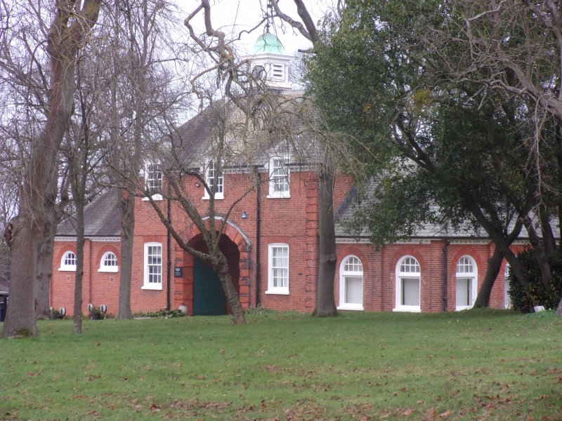
Stable block at
Upminster Court
TQ 58 NE 13/7A
II GV
2.
1905 by Professor Charles Reilly. Small red brick stable court in similar
style to Upminster Court. Three bay front with carriage entrance and pediment
over.
Listing NGR: TQ5643588007
External links are from the relevant listing authority and, where applicable, Wikidata. Wikidata IDs may be related buildings as well as this specific building. If you want to add or update a link, you will need to do so by editing the Wikidata entry.


Other nearby listed buildings
