Approximate Location Map
Large Map »
Latitude: 51.5685 / 51°34'6"N
Longitude: 0.2565 / 0°15'23"E
OS Eastings: 556483
OS Northings: 187924
OS Grid: TQ564879
Mapcode National: GBR W2.WWJ
Mapcode Global: VHHN8.DTFZ
Plus Code: 9F32H794+9H
Entry Name: Entrance Piers and Gates to Upminster Court
Listing Date: 14 September 1979
Grade: II
Source: Historic England
Source ID: 1079888
English Heritage Legacy ID: 201578
ID on this website: 101079888
Location: Cranham, Havering, London, RM14
County: London
District: Havering
Electoral Ward/Division: Cranham
Parish: Non Civil Parish
Built-Up Area: Havering
Traditional County: Essex
Lieutenancy Area (Ceremonial County): Greater London
Church of England Parish: Upminster St Laurence
Church of England Diocese: Chelmsford
Tagged with: Gate
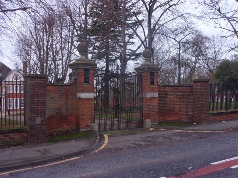
HALL LANE
1.
5017
Upminster
Entrance piers and
gates to Upminster Court
TQ 58 NE 13/7B
II GV
2.
1905. Red brick piers with stone ball finials. C18 style wrought iron gates.
Listing NGR: TQ5648387924
External links are from the relevant listing authority and, where applicable, Wikidata. Wikidata IDs may be related buildings as well as this specific building. If you want to add or update a link, you will need to do so by editing the Wikidata entry.


Other nearby listed buildings
