Approximate Location Map
Large Map »
Latitude: 51.6206 / 51°37'14"N
Longitude: 0.2264 / 0°13'35"E
OS Eastings: 554223
OS Northings: 193660
OS Grid: TQ542936
Mapcode National: GBR V4.FRW
Mapcode Global: VHHN1.WJ1G
Plus Code: 9F32J6CG+7H
Entry Name: Rose Cottages
Listing Date: 14 September 1979
Grade: II
Source: Historic England
Source ID: 1079906
English Heritage Legacy ID: 201617
ID on this website: 101079906
Location: Noak Hill, Havering, London, RM3
County: London
District: Havering
Electoral Ward/Division: Gooshays
Parish: Non Civil Parish
Traditional County: Essex
Lieutenancy Area (Ceremonial County): Greater London
Church of England Parish: Harold Hill St Paul and Noak Hill, St Thomas
Church of England Diocese: Chelmsford
Tagged with: Cottage
NOAK HILL ROAD
1.
5107
Noak Hill
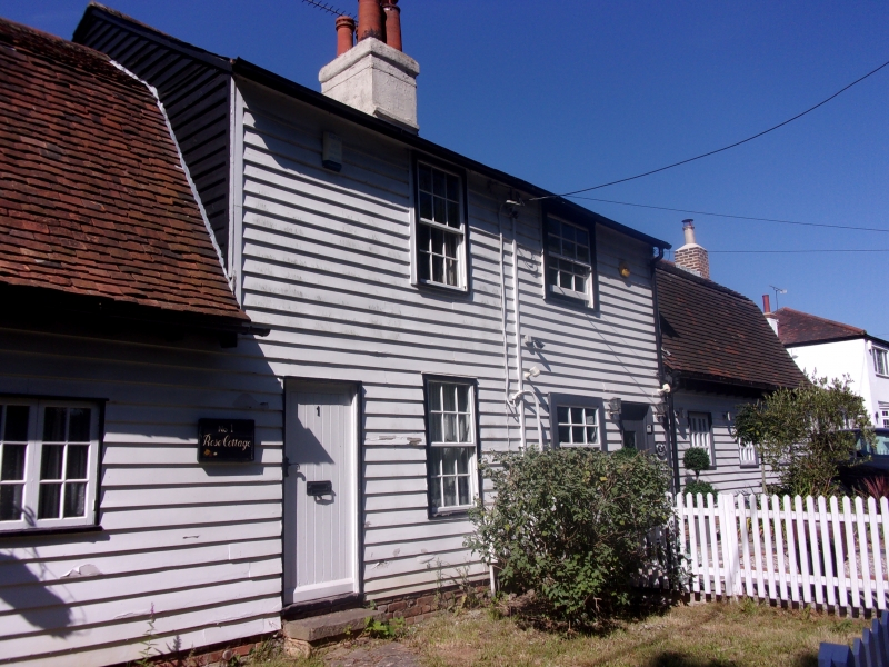
Rose Cottages
TQ 5493/5593 2/3
II GV
2.
Pair of early C19 timber-framed and weatherboarded cottages. Two storeys
and 2 windows wide, both entrances originally at outer end of front wall.
Axial stack, slate roof. Single-storey weatherboarded extension to west.
Listing NGR: TQ5422393660
External links are from the relevant listing authority and, where applicable, Wikidata. Wikidata IDs may be related buildings as well as this specific building. If you want to add or update a link, you will need to do so by editing the Wikidata entry.


Other nearby listed buildings
