Approximate Location Map
Large Map »
Latitude: 51.5574 / 51°33'26"N
Longitude: 0.2562 / 0°15'22"E
OS Eastings: 556504
OS Northings: 186690
OS Grid: TQ565866
Mapcode National: GBR W3.H8N
Mapcode Global: VHHNG.D39Y
Plus Code: 9F32H744+XF
Entry Name: 265 and 267, St Marys Lane
Listing Date: 14 September 1979
Grade: II
Source: Historic England
Source ID: 1079877
English Heritage Legacy ID: 201644
ID on this website: 101079877
Location: Upminster, Havering, London, RM14
County: London
District: Havering
Electoral Ward/Division: Upminster
Parish: Non Civil Parish
Built-Up Area: Havering
Traditional County: Essex
Lieutenancy Area (Ceremonial County): Greater London
Church of England Parish: Upminster St Laurence
Church of England Diocese: Chelmsford
Tagged with: Building
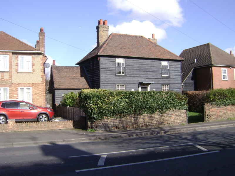
ST MARY'S LANE
1.
5017
Upminster
Nos 265 and 267
TQ 58 NE 13/17
II
2.
Early C19. Two storeys, painted weatherboarding, 2 sash windows. Central
treillage porch with tented lead roof. Hipped old tile roof, stock brick
stacks.
Listing NGR: TQ5650486690
External links are from the relevant listing authority and, where applicable, Wikidata. Wikidata IDs may be related buildings as well as this specific building. If you want to add or update a link, you will need to do so by editing the Wikidata entry.


Other nearby listed buildings
