Approximate Location Map
Large Map »
Latitude: 51.5956 / 51°35'44"N
Longitude: -0.3847 / 0°23'4"W
OS Eastings: 511983
OS Northings: 189759
OS Grid: TQ119897
Mapcode National: GBR 4D.3PL
Mapcode Global: VHFT0.85Z5
Plus Code: 9C3XHJW8+64
Entry Name: Milestone Outside the Oddfellows Arms Public House
Listing Date: 25 May 1983
Grade: II
Source: Historic England
Source ID: 1079730
English Heritage Legacy ID: 201977
ID on this website: 101079730
Location: Pinner, Harrow, London, HA5
County: London
District: Harrow
Electoral Ward/Division: Pinner
Parish: Non Civil Parish
Built-Up Area: Harrow
Traditional County: Middlesex
Lieutenancy Area (Ceremonial County): Greater London
Church of England Parish: St John Pinner
Church of England Diocese: London
Tagged with: Milestone
BRIDGE STREET
1.
5016
Pinner
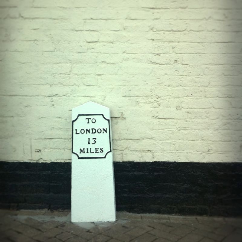
Milestone outside
The Oddfellows Arms Public House
TQ 1189 11/6
II
2.
Circa 1809. Rectangular stone about 2 ft 6 ins high inscribed: "To London 13 miles".
Listing NGR: TQ1198389759
External links are from the relevant listing authority and, where applicable, Wikidata. Wikidata IDs may be related buildings as well as this specific building. If you want to add or update a link, you will need to do so by editing the Wikidata entry.


Other nearby listed buildings
