Approximate Location Map
Large Map »
Latitude: 51.5929 / 51°35'34"N
Longitude: -0.3759 / 0°22'33"W
OS Eastings: 512599
OS Northings: 189475
OS Grid: TQ125894
Mapcode National: GBR 4D.CX1
Mapcode Global: VHFT0.F7M7
Plus Code: 9C3XHJVF+5J
Entry Name: The Grange Cottage
Listing Date: 19 December 1980
Last Amended: 25 May 1983
Grade: II
Source: Historic England
Source ID: 1358616
English Heritage Legacy ID: 202011
ID on this website: 101358616
Location: Pinner, Harrow, London, HA5
County: London
District: Harrow
Electoral Ward/Division: Pinner
Parish: Non Civil Parish
Built-Up Area: Harrow
Traditional County: Middlesex
Lieutenancy Area (Ceremonial County): Greater London
Church of England Parish: St John Pinner
Church of England Diocese: London
Tagged with: Cottage
CHURCH LANE
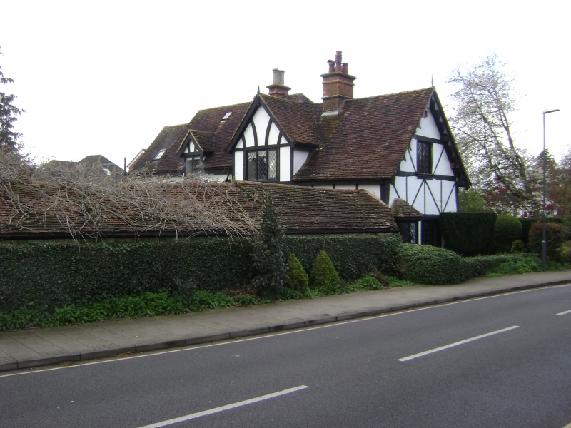
1.
5016
(south side)
Pinner
The Grange Cottage
TQ 18 NW 3/8 19.12.80
II GV
2.
C16 much modernised L-plan. Two-storeys with gabled tile roof. Timber framed with
brick infill (mainly imitation externally). Latticed casement windows.
Listing NGR: TQ1259989475
External links are from the relevant listing authority and, where applicable, Wikidata. Wikidata IDs may be related buildings as well as this specific building. If you want to add or update a link, you will need to do so by editing the Wikidata entry.


Other nearby listed buildings
