Approximate Location Map
Large Map »
Latitude: 51.5941 / 51°35'38"N
Longitude: -0.3818 / 0°22'54"W
OS Eastings: 512186
OS Northings: 189597
OS Grid: TQ121895
Mapcode National: GBR 4D.BD8
Mapcode Global: VHFT0.B6HB
Plus Code: 9C3XHJV9+J7
Entry Name: 7, High Street
Listing Date: 21 September 1951
Grade: II
Source: Historic England
Source ID: 1358633
English Heritage Legacy ID: 202090
ID on this website: 101358633
Location: Pinner, Harrow, London, HA5
County: London
District: Harrow
Electoral Ward/Division: Pinner
Parish: Non Civil Parish
Built-Up Area: Harrow
Traditional County: Middlesex
Lieutenancy Area (Ceremonial County): Greater London
Church of England Parish: St John Pinner
Church of England Diocese: London
Tagged with: Building
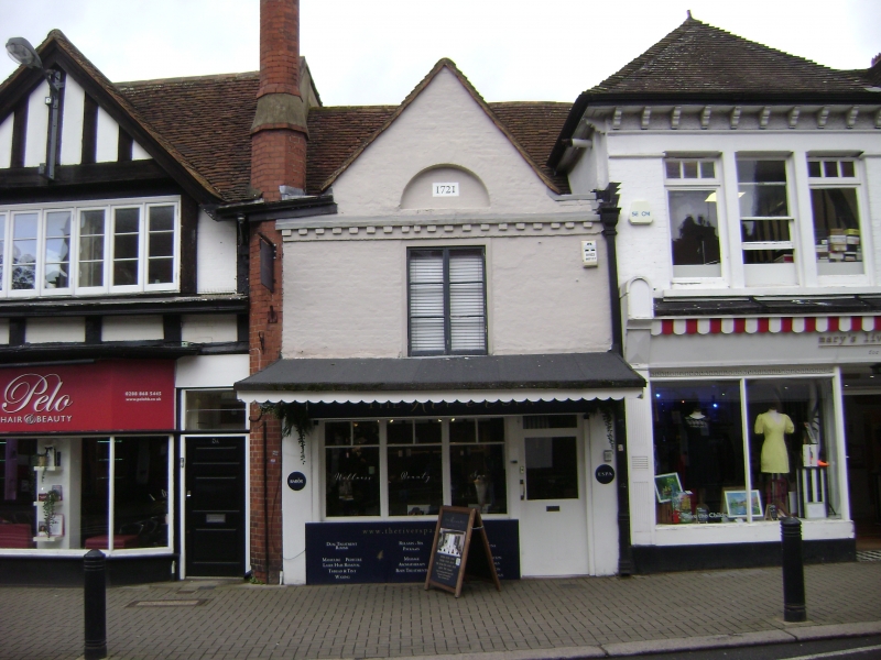
HIGH STREET
1.
5016
(north side)
Pinner
No 7
TQ 1289 NW 12/3 21.9.51
II GV
2.
Early C16, refaced in C18 brickwork (dated 1721). A very narrow building with the
shop occupying the whole of the frontage at ground floor level.
Listing NGR: TQ1218689597
External links are from the relevant listing authority and, where applicable, Wikidata. Wikidata IDs may be related buildings as well as this specific building. If you want to add or update a link, you will need to do so by editing the Wikidata entry.


Other nearby listed buildings
