Approximate Location Map
Large Map »
Latitude: 51.5941 / 51°35'38"N
Longitude: -0.3816 / 0°22'53"W
OS Eastings: 512199
OS Northings: 189598
OS Grid: TQ121895
Mapcode National: GBR 4D.BGG
Mapcode Global: VHFT0.B6LB
Plus Code: 9C3XHJV9+J8
Entry Name: 11, High Street
Listing Date: 1 March 1983
Grade: II
Source: Historic England
Source ID: 1079698
English Heritage Legacy ID: 202092
ID on this website: 101079698
Location: Pinner, Harrow, London, HA5
County: London
District: Harrow
Electoral Ward/Division: Pinner
Parish: Non Civil Parish
Built-Up Area: Harrow
Traditional County: Middlesex
Lieutenancy Area (Ceremonial County): Greater London
Church of England Parish: St John Pinner
Church of England Diocese: London
Tagged with: Building
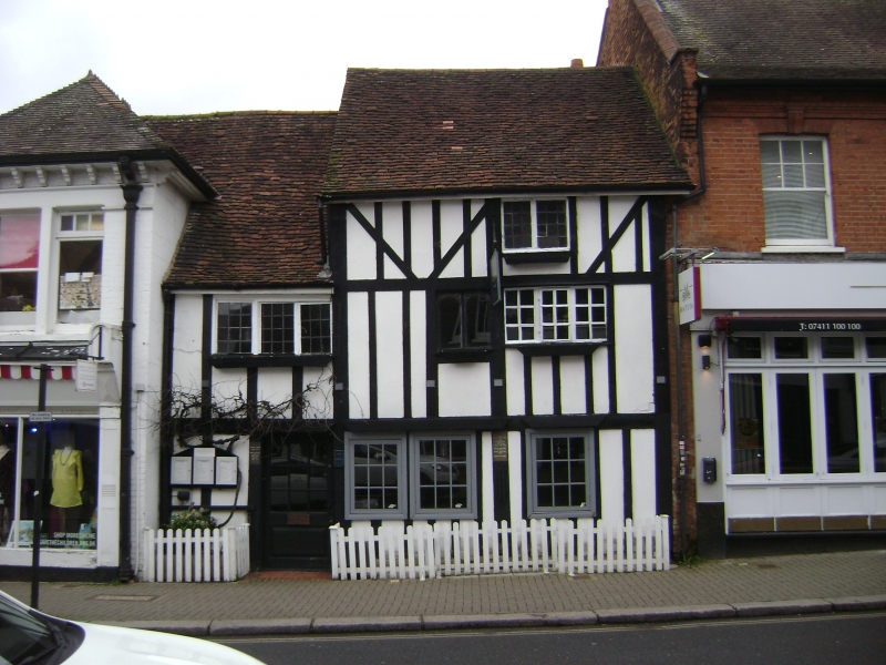
HIGH STREET
1.
5016
(north side)
Pinner
No 11
TQ 1289 NW 12/5 1.3.83
II GV
2.
Early C16 timber framed building. Two and 3-storeys. Two-bays under tiled roof.
Imitation timber framing to front elevation. Casement windows.
Listing NGR: TQ1219989598
External links are from the relevant listing authority and, where applicable, Wikidata. Wikidata IDs may be related buildings as well as this specific building. If you want to add or update a link, you will need to do so by editing the Wikidata entry.


Other nearby listed buildings
