Approximate Location Map
Large Map »
Latitude: 51.5943 / 51°35'39"N
Longitude: -0.3809 / 0°22'51"W
OS Eastings: 512252
OS Northings: 189627
OS Grid: TQ122896
Mapcode National: GBR 4D.BMV
Mapcode Global: VHFT0.C604
Plus Code: 9C3XHJV9+PM
Entry Name: 29, High Street
Listing Date: 9 July 1968
Grade: II
Source: Historic England
Source ID: 1079699
English Heritage Legacy ID: 202094
ID on this website: 101079699
Location: Pinner, Harrow, London, HA5
County: London
District: Harrow
Electoral Ward/Division: Pinner
Parish: Non Civil Parish
Built-Up Area: Harrow
Traditional County: Middlesex
Lieutenancy Area (Ceremonial County): Greater London
Church of England Parish: St John Pinner
Church of England Diocese: London
Tagged with: Building
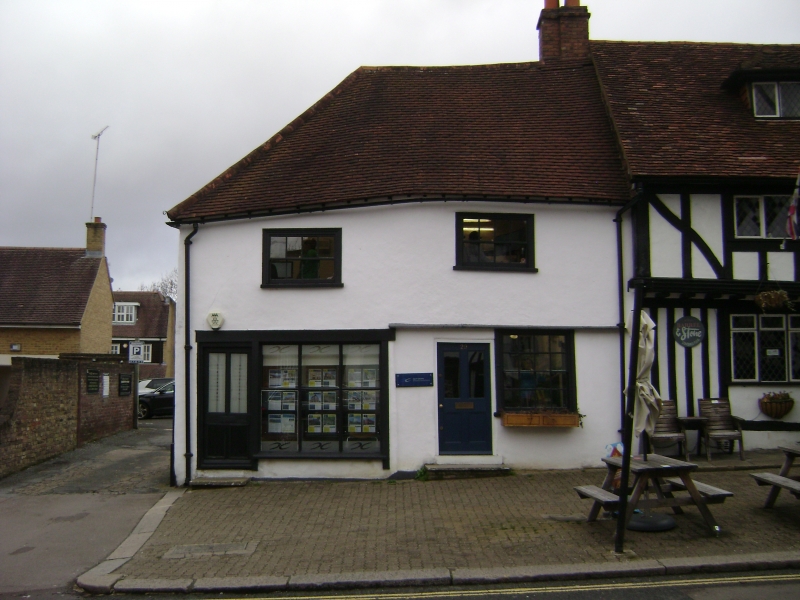
HIGH STREET
1.
5016
(north side)
Pinner
No 29
TQ 1289 NW 12/7 9.7.68
II GV
2.
C16 timber framing beneath modern tiles and re-plastering. Early C19 shop window.
May have been part of the Queen's Head at one time.
Listing NGR: TQ1224289642
External links are from the relevant listing authority and, where applicable, Wikidata. Wikidata IDs may be related buildings as well as this specific building. If you want to add or update a link, you will need to do so by editing the Wikidata entry.


Other nearby listed buildings
