Approximate Location Map
Large Map »
Latitude: 51.5941 / 51°35'38"N
Longitude: -0.3805 / 0°22'49"W
OS Eastings: 512281
OS Northings: 189608
OS Grid: TQ122896
Mapcode National: GBR 4D.BR6
Mapcode Global: VHFT0.C678
Plus Code: 9C3XHJV9+MR
Entry Name: The Hand in Hand Public House
Listing Date: 21 September 1951
Grade: II
Source: Historic England
Source ID: 1193708
English Heritage Legacy ID: 202104
ID on this website: 101193708
Location: Pinner, Harrow, London, HA5
County: London
District: Harrow
Electoral Ward/Division: Pinner
Parish: Non Civil Parish
Built-Up Area: Harrow
Traditional County: Middlesex
Lieutenancy Area (Ceremonial County): Greater London
Church of England Parish: St John Pinner
Church of England Diocese: London
Tagged with: Pub
TQ 1289 NW
12/23B
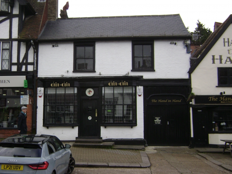
Pinner
HIGH STREET (south side)
No 38 (The Hand in Hand Public House)
21.9.51
GV
II
C18 or early C19. Painted brick. Two-storeys. Two sash windows on first floor. Vehicular through passage under right-hand end. C20 shopfront across rest. Slate roof.
Listing NGR: TQ1224989590
External links are from the relevant listing authority and, where applicable, Wikidata. Wikidata IDs may be related buildings as well as this specific building. If you want to add or update a link, you will need to do so by editing the Wikidata entry.


Other nearby listed buildings
