Approximate Location Map
Large Map »
Latitude: 51.5944 / 51°35'39"N
Longitude: -0.3794 / 0°22'45"W
OS Eastings: 512353
OS Northings: 189641
OS Grid: TQ123896
Mapcode National: GBR 4D.C02
Mapcode Global: VHFT0.C6S1
Plus Code: 9C3XHJVC+Q6
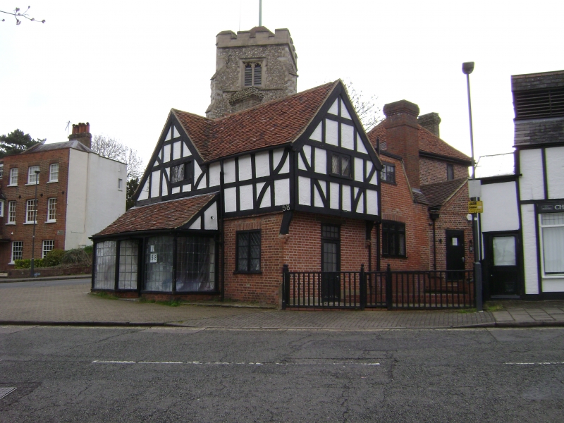
Entry Name: 58, High Street
Listing Date: 1 March 1983
Grade: II
Source: Historic England
Source ID: 1193713
English Heritage Legacy ID: 202106
ID on this website: 101193713
Location: Pinner, Harrow, London, HA5
County: London
District: Harrow
Electoral Ward/Division: Pinner
Parish: Non Civil Parish
Built-Up Area: Harrow
Traditional County: Middlesex
Lieutenancy Area (Ceremonial County): Greater London
Church of England Parish: St John Pinner
Church of England Diocese: London
Tagged with: Building
HIGH STREET
1.
5016
(south side)
Pinner
No 58
TQ 1289 NW 12/24 1.3.83
II
2.
Cl6 Two-storeys. Timber framed L-plan building. New brick ground-storey and modern
facing timbers to first-storey. Later additions to rear with jettied end onto
Grange Gardens. Old tiled roof.
Listing NGR: TQ1235389641
External links are from the relevant listing authority and, where applicable, Wikidata. Wikidata IDs may be related buildings as well as this specific building. If you want to add or update a link, you will need to do so by editing the Wikidata entry.


Other nearby listed buildings
