Approximate Location Map
Large Map »
Latitude: 51.5961 / 51°35'45"N
Longitude: -0.3849 / 0°23'5"W
OS Eastings: 511965
OS Northings: 189818
OS Grid: TQ119898
Mapcode National: GBR 4D.3M6
Mapcode Global: VHFT0.84VS
Plus Code: 9C3XHJW8+C2
Entry Name: 3, Waxwell Lane
Listing Date: 21 September 1951
Grade: II
Source: Historic England
Source ID: 1285718
English Heritage Legacy ID: 202194
ID on this website: 101285718
Location: Pinner, Harrow, London, HA5
County: London
District: Harrow
Electoral Ward/Division: Pinner
Parish: Non Civil Parish
Built-Up Area: Harrow
Traditional County: Middlesex
Lieutenancy Area (Ceremonial County): Greater London
Church of England Parish: St John Pinner
Church of England Diocese: London
Tagged with: Building
TQ 1189 11/4
5016
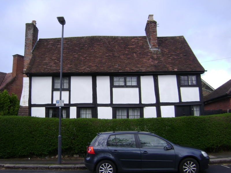
WAXWELL LANE (west side),
Pinner,
No 3
(Formerly listed as Nos 2 and 3)
21.9.51
II
C17. Plastered and timbered, with first floor overhung and small casements. Late
C18 brick building on north.
Listing NGR: TQ1196589818
External links are from the relevant listing authority and, where applicable, Wikidata. Wikidata IDs may be related buildings as well as this specific building. If you want to add or update a link, you will need to do so by editing the Wikidata entry.


Other nearby listed buildings
