Approximate Location Map
Large Map »
Latitude: 51.497 / 51°29'49"N
Longitude: -0.2501 / 0°15'0"W
OS Eastings: 521570
OS Northings: 179011
OS Grid: TQ215790
Mapcode National: GBR 9M.FLQ
Mapcode Global: VHGQX.MM4S
Plus Code: 9C3XFPWX+QX
Entry Name: 37, Bath Road W4
Listing Date: 2 February 1970
Grade: II
Source: Historic England
Source ID: 1079593
English Heritage Legacy ID: 202405
ID on this website: 101079593
Location: Bedford Park, Hounslow, London, W4
County: London
District: Hounslow
Electoral Ward/Division: Chiswick Homefields
Parish: Non Civil Parish
Built-Up Area: Hounslow
Traditional County: Middlesex
Lieutenancy Area (Ceremonial County): Greater London
Church of England Parish: St Michael and All Angels Bedford Park
Church of England Diocese: London
Tagged with: Building
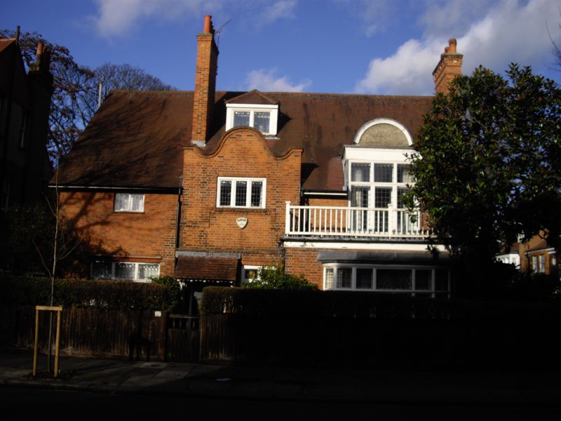
1. BATH ROAD W4
4419 (Bedford Park)
No 37
TQ 2179 SE 6/76 2.2.70.
II
2.
Shaped gable above entrance with hood. Long elaborate bay and conservatory
to return. 2 gate piers.
Listing NGR: TQ2157079011
External links are from the relevant listing authority and, where applicable, Wikidata. Wikidata IDs may be related buildings as well as this specific building. If you want to add or update a link, you will need to do so by editing the Wikidata entry.


Other nearby listed buildings
