Approximate Location Map
Large Map »
Latitude: 51.4841 / 51°29'2"N
Longitude: -0.3086 / 0°18'30"W
OS Eastings: 517544
OS Northings: 177485
OS Grid: TQ175774
Mapcode National: GBR 74.BVG
Mapcode Global: VHGQW.LYRN
Plus Code: 9C3XFMMR+JH
Entry Name: 36A, the Butts
Listing Date: 21 May 1973
Grade: II
Source: Historic England
Source ID: 1358686
English Heritage Legacy ID: 202461
ID on this website: 101358686
Location: Brentford, Hounslow, London, TW8
County: London
District: Hounslow
Electoral Ward/Division: Syon
Parish: Non Civil Parish
Built-Up Area: Hounslow
Traditional County: Middlesex
Lieutenancy Area (Ceremonial County): Greater London
Church of England Parish: Brentford St Paul
Church of England Diocese: London
Tagged with: Building
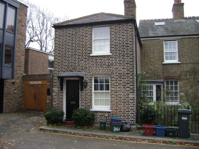
1. THE BUTTS, BRENTFORD
4419 (South Side)
No 36A
TQ 1777 SE 13/134
II GV
2.
C18. Brown brick. Hipped slate roof. 2-storey, 1 window, flat brick
arch, glazing bars. Flat stone arch to modern door with modern hood.
3 steps.
All the listed buildings in The Butts form a group.
Listing NGR: TQ1754477485
External links are from the relevant listing authority and, where applicable, Wikidata. Wikidata IDs may be related buildings as well as this specific building. If you want to add or update a link, you will need to do so by editing the Wikidata entry.


Other nearby listed buildings
