Approximate Location Map
Large Map »
Latitude: 51.4109 / 51°24'39"N
Longitude: -0.2965 / 0°17'47"W
OS Eastings: 518571
OS Northings: 169367
OS Grid: TQ185693
Mapcode National: GBR 83.V88
Mapcode Global: VHGR8.TS3R
Plus Code: 9C3XCP63+9C
Entry Name: Boundary Wall to Tiffin School
Listing Date: 6 October 1983
Grade: II
Source: Historic England
Source ID: 1080046
English Heritage Legacy ID: 203170
ID on this website: 101080046
Location: Norbiton, Kingston upon Thames, London, KT2
County: London
District: Kingston upon Thames
Electoral Ward/Division: Grove
Parish: Non Civil Parish
Built-Up Area: Kingston upon Thames
Traditional County: Surrey
Lieutenancy Area (Ceremonial County): Greater London
Church of England Parish: Norbiton St Peter
Church of England Diocese: Southwark
Tagged with: Wall
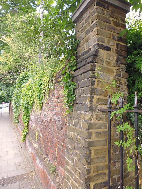
TQ 1869 SE KINGSTON-UPON-THAMES QUEEN ELIZABETH ROAD
(east side)
7B/5
Boundary wall to Tiffin
School
G.V. II
C17 or C18 red brick wall with one offset. Listed primarily for group value.
Listing NGR: TQ1857169367
External links are from the relevant listing authority and, where applicable, Wikidata. Wikidata IDs may be related buildings as well as this specific building. If you want to add or update a link, you will need to do so by editing the Wikidata entry.


Other nearby listed buildings
