Approximate Location Map
Large Map »
Latitude: 51.4567 / 51°27'24"N
Longitude: -0.0153 / 0°0'55"W
OS Eastings: 537985
OS Northings: 174945
OS Grid: TQ379749
Mapcode National: GBR L2.SYF
Mapcode Global: VHGR7.PN75
Plus Code: 9C3XFX4M+MV
Entry Name: Garden Walls to South and West of St Mary's Vicarage
Listing Date: 30 August 1954
Grade: II
Source: Historic England
Source ID: 1358500
English Heritage Legacy ID: 203336
ID on this website: 101358500
Location: Lewisham, London, SE13
County: London
District: Lewisham
Electoral Ward/Division: Lewisham Central
Parish: Non Civil Parish
Built-Up Area: Lewisham
Traditional County: Kent
Lieutenancy Area (Ceremonial County): Greater London
Church of England Parish: Lewisham St Mary
Church of England Diocese: Southwark
Tagged with: Wall
LEWISHAM HIGH STREET SE13
1.
4424 (West Side)
Garden Walls to
South and West of
St Mary's Vicarage
TQ 3774 18/L53A 30.8.54.
TQ 3874 19/L53A
II
2.
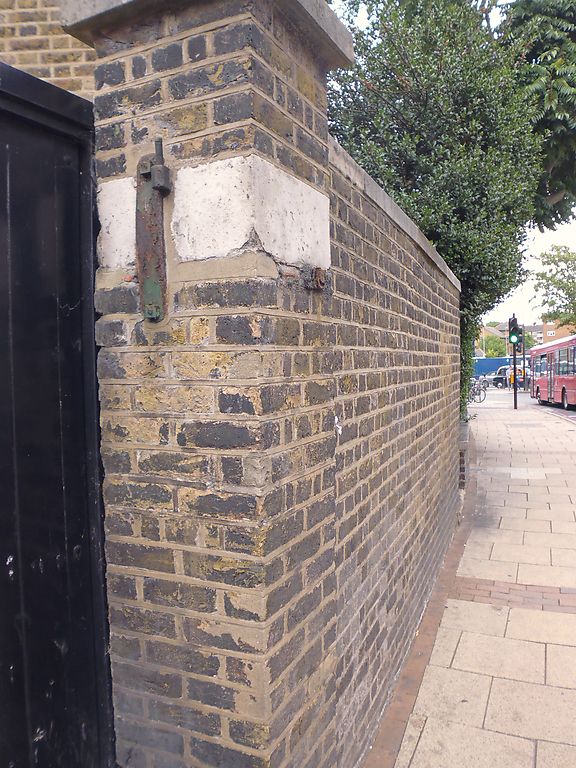
Brown brick walls of C18 appearance along front of Vicarage, where they
are low, and high around the garden.
Listing NGR: TQ3798574945
External links are from the relevant listing authority and, where applicable, Wikidata. Wikidata IDs may be related buildings as well as this specific building. If you want to add or update a link, you will need to do so by editing the Wikidata entry.


Other nearby listed buildings
