Approximate Location Map
Large Map »
Latitude: 51.4843 / 51°29'3"N
Longitude: -0.1642 / 0°9'51"W
OS Eastings: 527564
OS Northings: 177749
OS Grid: TQ275777
Mapcode National: GBR 7Q.92
Mapcode Global: VHGQZ.3YJH
Plus Code: 9C3XFRMP+P8
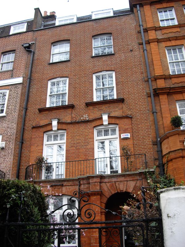
Entry Name: 2, Cheyne Walk SW3
Listing Date: 24 June 1954
Grade: II
Source: Historic England
Source ID: 1080720
English Heritage Legacy ID: 203649
ID on this website: 101080720
Location: Chelsea, Kensington and Chelsea, London, SW3
County: London
District: Kensington and Chelsea
Electoral Ward/Division: Chelsea Riverside
Parish: Non Civil Parish
Built-Up Area: Kensington and Chelsea
Traditional County: Middlesex
Lieutenancy Area (Ceremonial County): Greater London
Church of England Parish: St Luke and Christ Church Chelsea
Church of England Diocese: London
Tagged with: Building
TQ 2777 NE CHEYNE WALK SW3
63/12
24.6.54 No 2
GV II
Circa 1717, refronted 1879. Four-storey basement and dormers, 2 windows. Red brick.
Projecting ground storey. Segmental arches to windows.
Listing NGR: TQ2756477749
External links are from the relevant listing authority and, where applicable, Wikidata. Wikidata IDs may be related buildings as well as this specific building. If you want to add or update a link, you will need to do so by editing the Wikidata entry.


Other nearby listed buildings
