Approximate Location Map
Large Map »
Latitude: 51.484 / 51°29'2"N
Longitude: -0.1687 / 0°10'7"W
OS Eastings: 527256
OS Northings: 177706
OS Grid: TQ272777
Mapcode National: GBR 6Q.96
Mapcode Global: VHGQZ.1Y5R
Plus Code: 9C3XFRMJ+HG
Entry Name: Boundary Wall at Shrewsbury House
Listing Date: 15 April 1969
Grade: II
Source: Historic England
Source ID: 1080691
English Heritage Legacy ID: 203675
ID on this website: 101080691
Location: Chelsea, Kensington and Chelsea, London, SW3
County: London
District: Kensington and Chelsea
Electoral Ward/Division: Chelsea Riverside
Parish: Non Civil Parish
Built-Up Area: Kensington and Chelsea
Traditional County: Middlesex
Lieutenancy Area (Ceremonial County): Greater London
Church of England Parish: All Saints (Chelsea Old Church)
Church of England Diocese: London
Tagged with: Wall
TQ 2777 NW CHEYNE WALK SW3
62/61A
15.4.69 Boundary wall at
Shrewsbury House
II
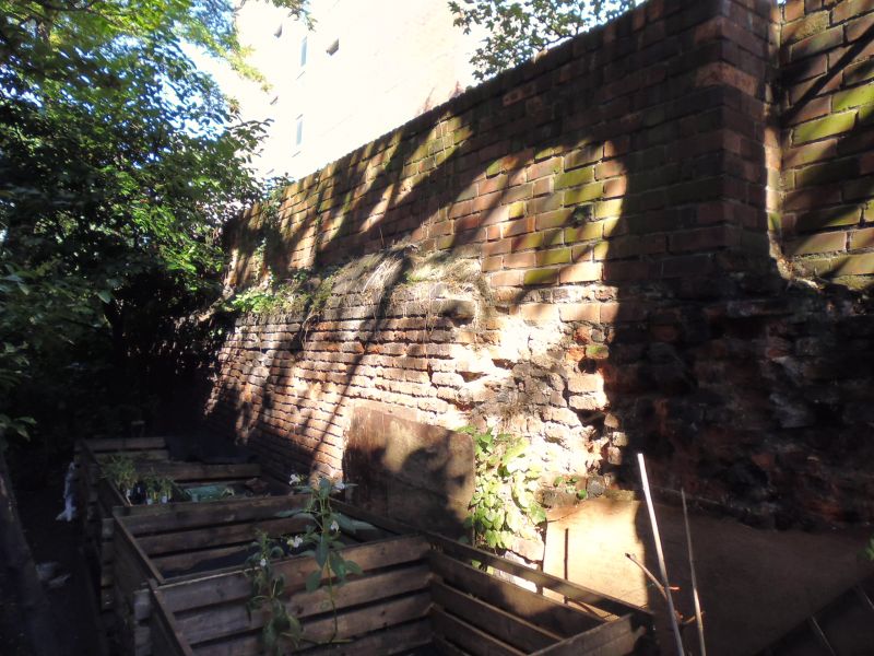
Wall. C16. Narrow red brick, varying height and variously patched and altered. In 3
sections. Part in poor repair. Boundary wall of C16. Shrewsbury House.
Listing NGR: TQ2726277658
External links are from the relevant listing authority and, where applicable, Wikidata. Wikidata IDs may be related buildings as well as this specific building. If you want to add or update a link, you will need to do so by editing the Wikidata entry.


Other nearby listed buildings
