Approximate Location Map
Large Map »
Latitude: 51.5301 / 51°31'48"N
Longitude: -0.2268 / 0°13'36"W
OS Eastings: 523097
OS Northings: 182732
OS Grid: TQ230827
Mapcode National: GBR BD.7HX
Mapcode Global: VHGQR.0SYX
Plus Code: 9C3XGQJF+27
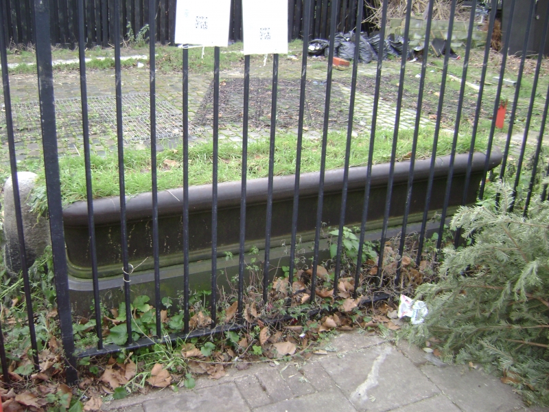
Entry Name: Trough Outside Number 665
Listing Date: 7 November 1984
Grade: II
Source: Historic England
Source ID: 1080627
English Heritage Legacy ID: 203820
ID on this website: 101080627
Location: Kensal Green, Brent, London, NW10
County: London
District: Brent
Electoral Ward/Division: Kensal Green
Parish: Non Civil Parish
Built-Up Area: Brent
Traditional County: Middlesex
Lieutenancy Area (Ceremonial County): Greater London
Church of England Parish: St Martin Kensal Rise
Church of England Diocese: London
Tagged with: Building
TQ 2382 NW HARROW ROAD W10
2/1
Trough outside
No 665
II
Mid to late C19. Cast iron water trough outside public house, with curved flange.
Listing NGR: TQ2309782732
External links are from the relevant listing authority and, where applicable, Wikidata. Wikidata IDs may be related buildings as well as this specific building. If you want to add or update a link, you will need to do so by editing the Wikidata entry.


Other nearby listed buildings
