Approximate Location Map
Large Map »
Latitude: 51.4867 / 51°29'12"N
Longitude: -0.1117 / 0°6'42"W
OS Eastings: 531205
OS Northings: 178112
OS Grid: TQ312781
Mapcode National: GBR MP.26
Mapcode Global: VHGR0.0WTM
Plus Code: 9C3XFVPQ+M8
Entry Name: 328, Kennington Road SE11
Listing Date: 27 March 1981
Grade: II
Source: Historic England
Source ID: 1299377
English Heritage Legacy ID: 204375
ID on this website: 101299377
Location: Vauxhall, Lambeth, London, SE11
County: London
District: Lambeth
Electoral Ward/Division: Oval
Parish: Non Civil Parish
Built-Up Area: Lambeth
Traditional County: Surrey
Lieutenancy Area (Ceremonial County): Greater London
Church of England Parish: Kennington St Mark
Church of England Diocese: Southwark
Tagged with: Building
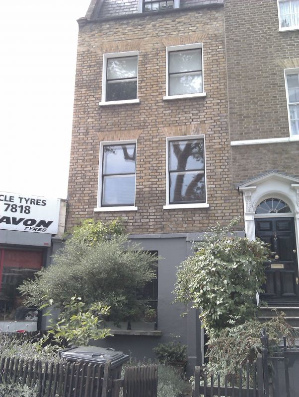
1.
5023
TQ 3178
5/561
KENNINGTON ROAD SE11
(west side)
No 328
II
GV
2.
Late C18 house of three storeys and basement, two windows. Stock brick with stone-coped
parapet. Stuccoed with incised lines. Gauged flat brick arches to sash windows.
Narrow C19 four-panel door with rectangular fanlight. Included for group value.
Listing NGR: TQ3120578112
External links are from the relevant listing authority and, where applicable, Wikidata. Wikidata IDs may be related buildings as well as this specific building. If you want to add or update a link, you will need to do so by editing the Wikidata entry.


Other nearby listed buildings
