Approximate Location Map
Large Map »
Latitude: 51.4581 / 51°27'29"N
Longitude: -0.1289 / 0°7'44"W
OS Eastings: 530092
OS Northings: 174896
OS Grid: TQ300748
Mapcode National: GBR FW.VK9
Mapcode Global: VHGR5.QM62
Plus Code: 9C3XFV5C+6C
Entry Name: Horse Trough North West of Number 1
Listing Date: 27 March 1981
Grade: II
Source: Historic England
Source ID: 1080365
English Heritage Legacy ID: 204386
ID on this website: 101080365
Location: Clapham, Lambeth, London, SW4
County: London
District: Lambeth
Electoral Ward/Division: Brixton Hill
Parish: Non Civil Parish
Built-Up Area: Lambeth
Traditional County: Surrey
Lieutenancy Area (Ceremonial County): Greater London
Church of England Parish: Clapham St James
Church of England Diocese: Southwark
Tagged with: Building
KINGS AVENUE SW4
1. (east side)
5023
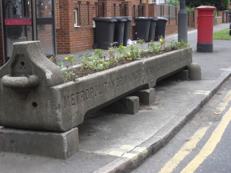
Horse trough
north-west of No 1
TQ 3074 22/574
II
2.
Long trough of pinkish grey granite, circa 1900. Gabled north end with small
semi-circular basin. Erected by Metropolitan Drinking Fountain and Cattle Trough
Association.
Listing NGR: TQ3009274896
External links are from the relevant listing authority and, where applicable, Wikidata. Wikidata IDs may be related buildings as well as this specific building. If you want to add or update a link, you will need to do so by editing the Wikidata entry.


Other nearby listed buildings
