Approximate Location Map
Large Map »
Latitude: 51.4963 / 51°29'46"N
Longitude: -0.1134 / 0°6'48"W
OS Eastings: 531060
OS Northings: 179168
OS Grid: TQ310791
Mapcode National: GBR LK.PS
Mapcode Global: VHGQZ.ZNFB
Plus Code: 9C3XFVWP+GJ
Entry Name: 140 and 142, Lambeth Road
Listing Date: 27 March 1981
Grade: II
Source: Historic England
Source ID: 1116334
English Heritage Legacy ID: 204408
ID on this website: 101116334
Location: Lambeth, London, SE1
County: London
District: Lambeth
Electoral Ward/Division: Bishop's
Parish: Non Civil Parish
Built-Up Area: Lambeth
Traditional County: Surrey
Lieutenancy Area (Ceremonial County): Greater London
Church of England Parish: North Lambeth
Church of England Diocese: Southwark
Tagged with: Building
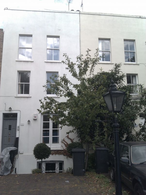
1. LAMBETH ROAD SE1
5023 (north side)
Nos 140 and 142
TQ 3179 3/595
II GV
2.
Early C19 pair, each three storeys and basement, two windows. Stucco with parapet.
Replaced sash windows except for original long ground floor casements. Modern
doors with rectangular fanlights.
Listing NGR: TQ3106079168
External links are from the relevant listing authority and, where applicable, Wikidata. Wikidata IDs may be related buildings as well as this specific building. If you want to add or update a link, you will need to do so by editing the Wikidata entry.


Other nearby listed buildings
