Approximate Location Map
Large Map »
Latitude: 51.4691 / 51°28'8"N
Longitude: -0.1399 / 0°8'23"W
OS Eastings: 529296
OS Northings: 176097
OS Grid: TQ292760
Mapcode National: GBR DW.RK
Mapcode Global: VHGR5.JBDN
Plus Code: 9C3XFV96+J2
Entry Name: Wall Bordering East Side of St Pauls Churchyard
Listing Date: 27 March 1981
Grade: II
Source: Historic England
Source ID: 1064970
English Heritage Legacy ID: 204583
ID on this website: 101064970
Location: Clapham, Lambeth, London, SW4
County: London
District: Lambeth
Electoral Ward/Division: Clapham Town
Parish: Non Civil Parish
Built-Up Area: Lambeth
Traditional County: Surrey
Lieutenancy Area (Ceremonial County): Greater London
Church of England Parish: Clapham St Paul
Church of England Diocese: Southwark
Tagged with: Wall
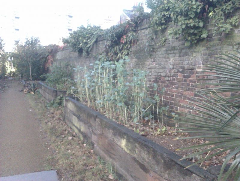
RECTORY GROVE SW4
1. (north end)
5023
Wall bordering east side
of St Pauls Churchyard
TQ 2976 11/481
II GV
2.
C18 red brick wall with sloped top and tapered flat buttresses. Several later
courses added.
Listing NGR: TQ2929676097
External links are from the relevant listing authority and, where applicable, Wikidata. Wikidata IDs may be related buildings as well as this specific building. If you want to add or update a link, you will need to do so by editing the Wikidata entry.


Other nearby listed buildings
