Approximate Location Map
Large Map »
Latitude: 51.4356 / 51°26'8"N
Longitude: -0.0941 / 0°5'38"W
OS Eastings: 532573
OS Northings: 172460
OS Grid: TQ325724
Mapcode National: GBR GS.BY3
Mapcode Global: VHGRD.B53S
Plus Code: 9C3XCWP4+79
Entry Name: Forecourt Railings to South of the Rosendale Public House
Listing Date: 16 May 1975
Grade: II
Source: Historic England
Source ID: 1064977
English Heritage Legacy ID: 204597
ID on this website: 101064977
Location: West Dulwich, Lambeth, London, SE21
County: London
District: Lambeth
Electoral Ward/Division: Gipsy Hill
Parish: Non Civil Parish
Built-Up Area: Lambeth
Traditional County: Surrey
Lieutenancy Area (Ceremonial County): Greater London
Church of England Parish: West Dulwich Emmanuel
Church of England Diocese: Southwark
Tagged with: Guard rail
ROSENDALE ROAD SE21
1. (west side)
5023
Forecourt railings to
south of The Rosendale
Public House
TQ 3272 32/814 16.5.75
II
2.
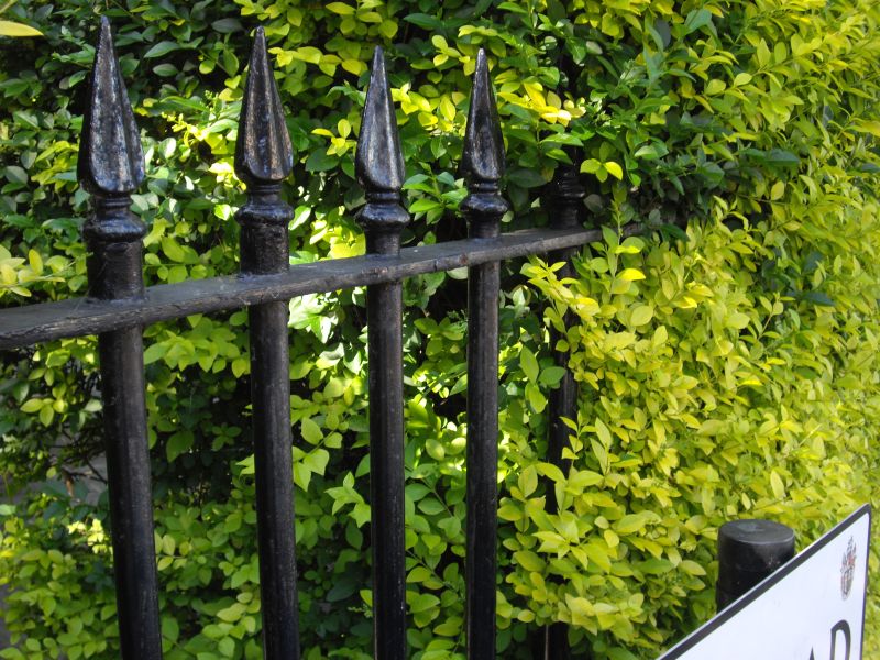
Early-mid C19 cast iron railings, with spearhead standards and feather finials.
Listing NGR: TQ3257372460
External links are from the relevant listing authority and, where applicable, Wikidata. Wikidata IDs may be related buildings as well as this specific building. If you want to add or update a link, you will need to do so by editing the Wikidata entry.


Other nearby listed buildings
