Approximate Location Map
Large Map »
Latitude: 51.4724 / 51°28'20"N
Longitude: -0.1324 / 0°7'56"W
OS Eastings: 529811
OS Northings: 176476
OS Grid: TQ298764
Mapcode National: GBR GV.GC
Mapcode Global: VHGR5.N8D4
Plus Code: 9C3XFVC9+W3
Entry Name: Forecourt Wall to Christ Church and Vicarage
Listing Date: 27 March 1979
Grade: II
Source: Historic England
Source ID: 1347935
English Heritage Legacy ID: 204719
ID on this website: 101347935
Location: Union Mews, Lambeth, London, SW8
County: London
District: Lambeth
Electoral Ward/Division: Larkhall
Parish: Non Civil Parish
Built-Up Area: Lambeth
Traditional County: Surrey
Lieutenancy Area (Ceremonial County): Greater London
Church of England Parish: Clapham Christ Church with St John
Church of England Diocese: Southwark
Tagged with: Wall
UNION GROVE SW8
1. (east side)
5023
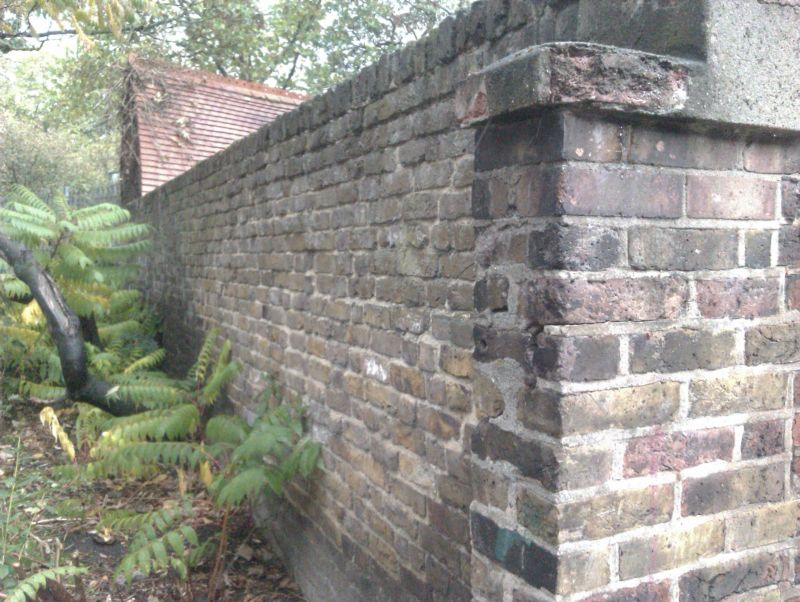
Forecourt wall to
Christ Church and
Vicarage
TQ 2976 11/975 27.3.79
II GV
2.
Later C19 tall red brick wall, raised in front of Vicarage and having pointed
arched entrance.
Listing NGR: TQ2981176476
External links are from the relevant listing authority and, where applicable, Wikidata. Wikidata IDs may be related buildings as well as this specific building. If you want to add or update a link, you will need to do so by editing the Wikidata entry.


Other nearby listed buildings
