Approximate Location Map
Large Map »
Latitude: 51.5769 / 51°34'36"N
Longitude: 0.032 / 0°1'55"E
OS Eastings: 540899
OS Northings: 188399
OS Grid: TQ408883
Mapcode National: GBR MJ.6QN
Mapcode Global: VHHN4.HMRK
Plus Code: 9F32H2GJ+PQ
Entry Name: Elm Hall
Listing Date: 20 December 1954
Grade: II
Source: Historic England
Source ID: 1300611
English Heritage Legacy ID: 204808
ID on this website: 101300611
Location: Wanstead, Redbridge, London, E11
County: London
District: Redbridge
Electoral Ward/Division: Wanstead
Parish: Non Civil Parish
Built-Up Area: Redbridge
Traditional County: Essex
Lieutenancy Area (Ceremonial County): Greater London
Church of England Parish: Wanstead St Mary with Christ Church
Church of England Diocese: Chelmsford
Tagged with: House
EASTERN AVENUE
1.
5027
E11
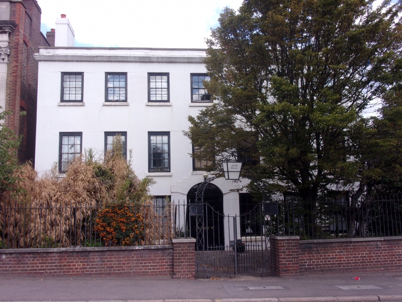
Elm Hall
TQ 4088 14/18 20.12.54
II
2.
Early C18. Three storeys, rendered, 7 sashes. Central round headed doorway.
Mutilated cornice, parapet, hipped slate roof, end stacks, rear of brown brick
with red dressings, large projecting bay added in early C19. Interior has
good panelled entrance hall with staircase.
Listing NGR: TQ4089988399
External links are from the relevant listing authority and, where applicable, Wikidata. Wikidata IDs may be related buildings as well as this specific building. If you want to add or update a link, you will need to do so by editing the Wikidata entry.


Other nearby listed buildings
