Approximate Location Map
Large Map »
Latitude: 51.6135 / 51°36'48"N
Longitude: 0.0934 / 0°5'36"E
OS Eastings: 545042
OS Northings: 192596
OS Grid: TQ450925
Mapcode National: GBR P3.XYM
Mapcode Global: VHHMZ.KPRY
Plus Code: 9F32J37V+C9
Entry Name: 195-209, Manor Road
Listing Date: 22 February 1979
Grade: II
Source: Historic England
Source ID: 1081003
English Heritage Legacy ID: 204852
ID on this website: 101081003
Location: Grange Hill, Redbridge, London, IG7
County: London
District: Redbridge
Electoral Ward/Division: Hainault
Parish: Non Civil Parish
Built-Up Area: Redbridge
Traditional County: Essex
Lieutenancy Area (Ceremonial County): Greater London
Tagged with: Building
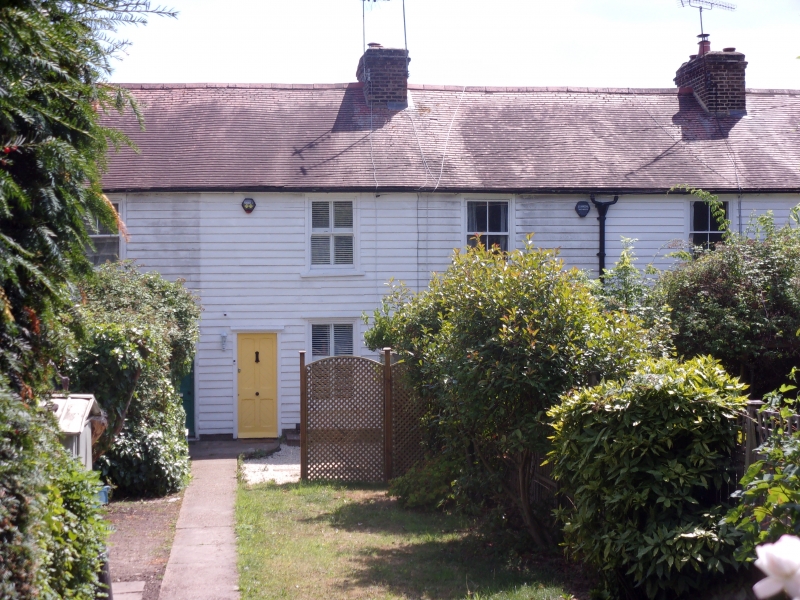
MANOR ROAD
1.
5027
Chigwell
Nos 195 to 209 (odd)
TQ 49 SE 3/1
II
2.
Probably early/mid C19. Terrace of cottages. Two-storeys. White-painted weather-
boarding on brick plinth. Hipped roof in plain tiles. Double hung sash windows.
Four panel doors with diagonal planked panels.
Listing NGR: TQ4504292596
External links are from the relevant listing authority and, where applicable, Wikidata. Wikidata IDs may be related buildings as well as this specific building. If you want to add or update a link, you will need to do so by editing the Wikidata entry.


Other nearby listed buildings
