Approximate Location Map
Large Map »
Latitude: 51.5835 / 51°35'0"N
Longitude: 0.0179 / 0°1'4"E
OS Eastings: 539903
OS Northings: 189107
OS Grid: TQ399891
Mapcode National: GBR LN.WQN
Mapcode Global: VHHN4.8G9G
Plus Code: 9F32H2M9+94
Entry Name: 57, Snaresbrook Road E11
Listing Date: 21 May 1974
Grade: II
Source: Historic England
Source ID: 1357972
English Heritage Legacy ID: 204874
ID on this website: 101357972
Location: Snaresbrook, Redbridge, London, E11
County: London
District: Redbridge
Electoral Ward/Division: Snaresbrook
Parish: Non Civil Parish
Built-Up Area: Redbridge
Traditional County: Essex
Lieutenancy Area (Ceremonial County): Greater London
Church of England Parish: Wanstead St Mary with Christ Church
Church of England Diocese: Chelmsford
Tagged with: Building
SNARESBROOK ROAD
1.
5027
E11
No 57
TQ 38 NE 4/3 21.5.74
II
2.
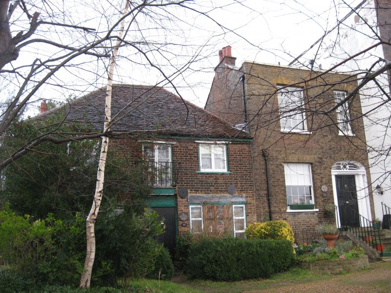
Probably late C18. Two storey stock brick coachhouse adjoining Willow Holme
on the left and in the same plane. Old tile roof, coachhouse doors on ground
floor.
Listing NGR: TQ3990589107
External links are from the relevant listing authority and, where applicable, Wikidata. Wikidata IDs may be related buildings as well as this specific building. If you want to add or update a link, you will need to do so by editing the Wikidata entry.


Other nearby listed buildings
