Approximate Location Map
Large Map »
Latitude: 51.4571 / 51°27'25"N
Longitude: -0.3035 / 0°18'12"W
OS Eastings: 517961
OS Northings: 174491
OS Grid: TQ179744
Mapcode National: GBR 80.S61
Mapcode Global: VHGR2.PMDV
Plus Code: 9C3XFM4W+RH
Entry Name: Cast Iron Standard at Junction with the Vineyard
Listing Date: 25 June 1983
Grade: II
Source: Historic England
Source ID: 1065320
English Heritage Legacy ID: 205689
ID on this website: 101065320
Location: Richmond upon Thames, London, TW10
County: London
District: Richmond upon Thames
Electoral Ward/Division: South Richmond
Parish: Non Civil Parish
Built-Up Area: Richmond upon Thames
Traditional County: Surrey
Lieutenancy Area (Ceremonial County): Greater London
Church of England Parish: Richmond
Church of England Diocese: Southwark
Tagged with: Building
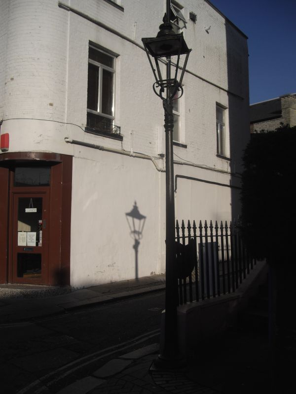
1.
5028 RICHMOND HILL
(east side)
Cast-iron standard.
At junction with The
Vineyard
TQ 1774 SE 20B/11
II GV
2.
A C19 slender cast-iron standard probably once bearing a road name.
Listing NGR: TQ1796174491
External links are from the relevant listing authority and, where applicable, Wikidata. Wikidata IDs may be related buildings as well as this specific building. If you want to add or update a link, you will need to do so by editing the Wikidata entry.


Other nearby listed buildings
